We call them pigeons. Birders have called them rock doves. Apparently now, the powers that be in the bird world have declared them to be rock pigeons.
One of the most familiar birds worldwide, these chunky, multicolored birds have adapted so well that we can find them in cities and farm fields, in parks and on rocky cliffs. They are members of the Columbidae family, along with all other pigeons and doves.
Their natural diet includes seeds and fruits, but they’re excellent scavengers, loitering in places where people gather and tend to drop morsels that can be snatched. They are equally creative in using various spaces for their nests.
Pigeon skills in navigation and homing proved valuable during World Wars I and II, when they were used by the U.S. Army Signal Corps to carry messages.
Numbers Declining
Though pigeons seem ubiquitous, the North American Breeding Bird Survey (BBS) estimates that the population has declined by almost 50 percent since 1966. The survey is a long-term, large-scale cooperative effort of the U.S. Geological Survey’s Patuxent Wildlife Research Center and the Canadian Wildlife Service.
The program began in 1966, led by Chandler Robbins, a researcher at Patuxent and good friend of Rachel Carson, who penned the landmark book Silent Spring. Her book alerted the world to the effects of pesticides on bird populations, but was considered quite controversial when it was published. Robbins died in 2017, just short of his 99th birthday. He was a renowned ornithologist and often birded with Carson. You can read more about them at http://www.rachelcarson.org/mChanRobbins.aspx
The BBS continues to be an important tool in avian research and the formation of conservation programs.
The global population of pigeons is estimated at 120 million and though declining in North America, they are not currently a species of concern.
Watching pigeon behavior can be a fun past time. Recently while waiting at a bus stop in downtown Seattle, I watched a group of them ambling about. It’s fun to make your own narrative of what’s going on.
Forming a strategy Gone to the dark side Walking the line Going their separate ways
The tag on my souvenir bottle of Mount St. Helens ash reads:
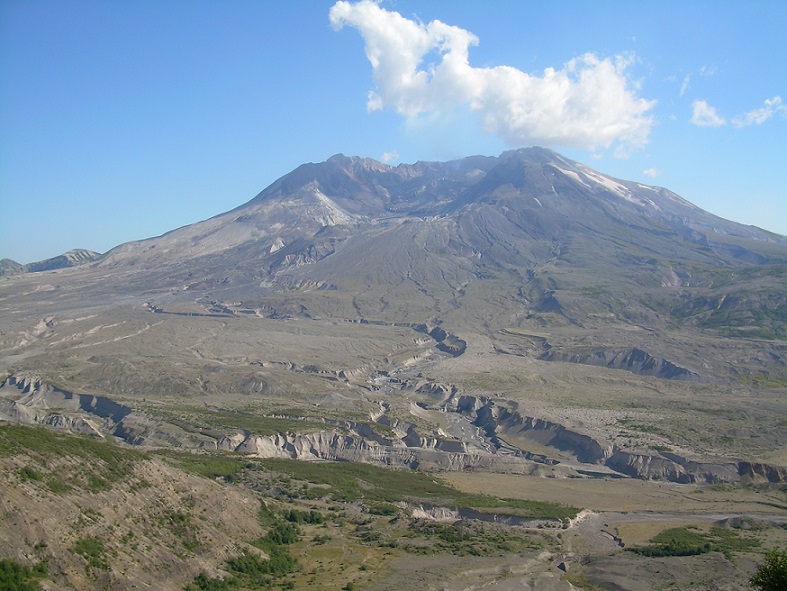
On May 18, 1980, a 5.1 magnitude earthquake triggered an enormous landslide, uncorking a monstrous volcanic eruption which blew 1300 feet off the top and north face of Mount St. Helens. The blast relocated 1.5 cubic miles of mountain and flattened 230 square miles of timberland, killing virtually all life within its zone.
Superheated gas and clouds of volcanic ash shot more than 17 miles into the atmosphere and around the earth. Hot ash melted ice and snow, triggering a mudflow and flood containing more than 130 million cubic yards of debris.
Thirty-eight years ago this country witnessed a startling natural event within our own borders. I am old enough to remember the disastrous eruption of Mount St. Helens. I was living on the east coast at the time, so it was basically a drama unfolding on TV. Within a day of the blast, ash had traveled to the midwestern states, and a couple days later fine ash had even reached the northeast.
Back then, I never imagined I would move to the west coast or ever visit Mount St. Helens, but in 2007, after moving west, I did visit the National Volcanic Monument.
Approaching the volcano, I saw the path of the winds and ash: downed trees all facing the same way, layers of ash still in and around Toutle River.
The Toutle River, with Mount St. Helens in the background
The blast zone, I thought. The blast zone, where all things in its path were blown down, covered in ash or obliterated. Once green, forested lands were now gray.
It was a spooky landscape. Scary words like lahar, pyroclastic flows and blast zone echoed in my head.
The eruption had changed the shape of the mountain and filled Spirit Lake with ash, debris and trees. Fifty-seven people had died.
The visitor center has an excellent, sobering documentary about the volcano. Images of thick billowing ash clouds rising from the crater are singed in my memories. They are reminiscent of Vesuvius.
Visitor Center
Today, vegetation continues to rebound, and the volcano still sends up steam.
From 2004-2008 the volcano reawakened with some dome building. There are frequent small, local earthquakes. Geologists continuously monitor its activity.
After driving through the Mount St. Helens blast zone back then, and experiencing ash fall from wildfires in eastern Washington just a couple years ago, I could imagine what it was like to suffer the ash clouds from St. Helens. I would never choose to live so close to a mountain that could erupt, or to forests that could burn.
Disclaimer: My images are 10 years old, so these scenes might look slightly different today.
Since I moved to the Pacific Northwest 11 years ago, volcanoes and earthquakes have become part of my consciousness. Not a very loud part, more of vague background noise, but always there nonetheless.
Mount Rainier
I live two hours from Mount Rainier, and three from Mount St. Helens, but their presence looms as a constant reminder of the earth’s capacity for fiery temper tantrums. We also have major oceanic plates that are subject to slipping, providing constant earthquake potential.
According to scientists, whom you may or may not trust at this point, the earth is made up of plates, which occasionally move around. This causes inconvenient episodes in human life, such as earthquakes and tsunamis. In geology class, I learned about the process of subduction, when one plate rides over and pushes down another. In my region, the Juan de Fuca Plate is subducting under the North American Plate, in the Cascadia subduction zone. Cool! I get to live in a subduction zone.
But, despite all of this, people here go about their lives without much thought to the potential catastrophes ever present, much like the residents of Hawaii, who dare to live on a dry rocky landscape that once flowed unimaginably hot from the center of the earth.
The Hawaiian islands were formed by lava spewing up, building, building, building, until there were blobs of land where there were none before. And the residents there are no different from those of my region. They are aware of the dangers, but decide that they can live with them. Nature’s beauty and all the other reasons we choose to live where we do outweigh the seemingly distant dangers.
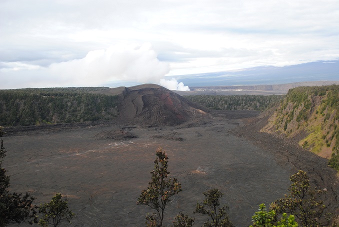
In light of the current eruptions of Kilauea, I wanted to revisit my experiences on Hawaii, Maui and at Mount St. Helens.
Kilauea
When I visited the Big Island in 2011, half of Volcanoes National Park was closed to visitors because of toxic fumes. Though there were no swaths of red-orange glowing lava flowing at that time, sulfur dioxide is constantly being released from fissures in the earth and can be become concentrated at dangerous levels. I got a mild whiff of it and it’s not pleasant.
Today, it seems that Pele is reasserting her authority. Pele is the revered goddess, the creator of the island. People leave tributes of leaves and flowers to her at the volcano and other places.
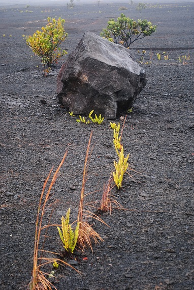
All over half the island, you can see vast fields of blackish boulders and debris from old lava flows. Near the water, the cooled lava shows intriguing swirls and shapes.
Old lava flows seen in the ocean
Volcanoes National Park
Tree hole, where lava surrounded and incinerated a tree
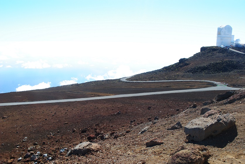
Haleakala
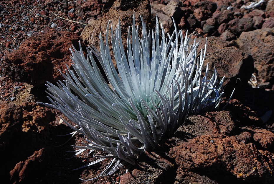
On Maui, the House of the Sun, aka Haleakala, is a major attraction. At 10,000 feet, the volcano dominates the island, providing a cool, arid counter to the warm, moist palm tree-laden lowlands. I visited in February this year.
As you drive into the Upcountry region, you climb slowly and steadily, until you enter a completely different landscape. Vegetation becomes sparse and close to the earth. A rocky crust of lava covers the area. Black boulders and reddish dirt begin to appear. Finally, at the summit, there is a spectrum of red, brown and gray. Known as a shield volcano, Haleakala is thought to have last erupted in the 17th century.
Haleakala is actually a caldera, a large depression left by an erupting volcano. It is a collection of mounds and craters. The unique and beautiful Maui subspecies of silversword grows there, and there is an observatory at the top. All the white stuff in my photos are clouds, not steam.
On Volcanoes, Part 2 continues with Mount St. Helens
Doesn’t it always happen this way? You never find something when you’re looking for it, and then, when you’re not looking for it at all, you stumble across it!
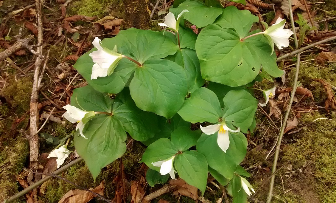
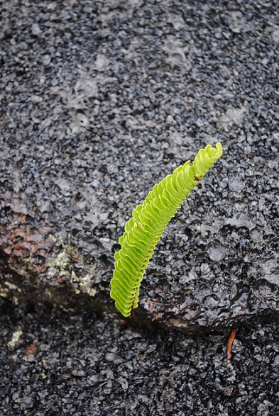
That’s what happened today as I was walking through a park, searching for raptor nests. I spied a possible nest cavity in a snag and made my way along a muddy path to the bottom of the tree. Suddenly, I saw two trillium plants.
What a happy sight! Native western trillium in bloom! This spot was remote enough, though seemingly used by transients, that it might survive as a trillium refuge. I had searched another area unsuccessfully, where I had seen the flowers several years ago. I’m happy that there are still some in the heavily used park.
Scenes like this always bring to mind the phrase Brother Sun Sister Moon, which happens to be the title of a 70s film about Saint Francis of Assisi by Franco Zeffirelli.
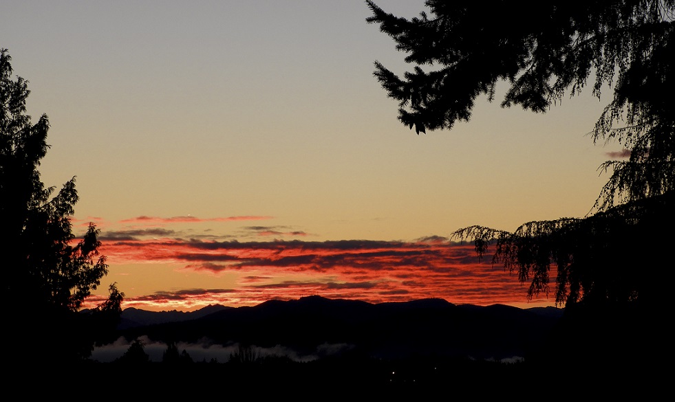
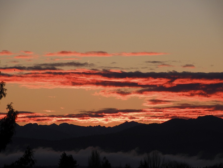
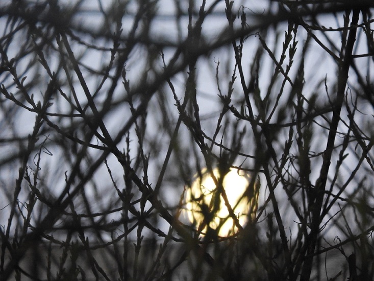
This morning’s sunrise blazes in the east, while the full moon bids farewell in the western sky.
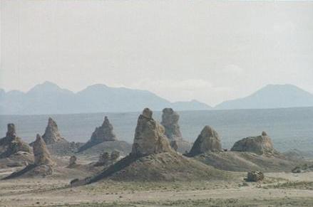
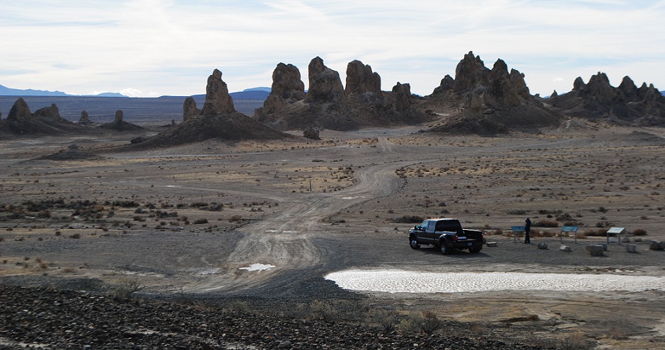
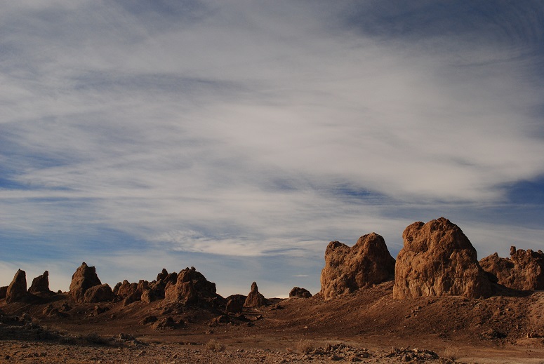
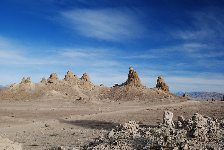
If Trona Pinnacles looks like something out of a sci-fi flick, that’s because it has indeed served as a backdrop for several movies. You might have heard of some of these: Star Wars, Star Trek V, Battlestar Galactica, Planet of the Apes.
First Impressions
I first drove to the Pinnacles in 2005, during a visit to Death Valley National Park. I had set aside part of one day to make the drive to the somewhat remote area managed by the Bureau of Land Management. But it took more than an hour to get there, and I had made arrangements for an afternoon horseback ride at Furnace Creek, back in Death Valley. By the time I got to the Pinnacles, I had about a half hour to spend there if I wanted to make my ride. I peered at the Pinnacles from a plateau that overlooked what I thought was a rather limited formation. There was a steep-looking road down to the Pinnacles, but I “there’s no way I’m driving down there,” I decided. I quickly snapped some photos from the parking area and sped back to Furnace Creek.
First visit
There would be a return trip in my future.
A Closer Look
It wasn’t until January 2017 that I made it back to Trona. I had planned to spend unlimited time there, doing lots of photography and some hiking. I lucked out with a dry day. This time I had rented an SUV, so I had high clearance, though a car could make it.
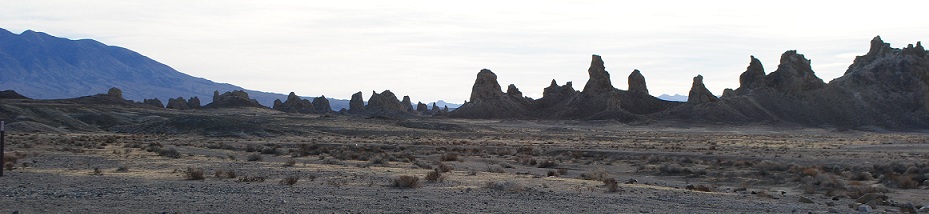
I drove south through Trona, and spotted the Pinnacles, rising like the Emerald City out of the desert. I arrived at the turnoff for the Pinnacles about 10 miles later. At the corner there are some interpretive signs about the human and geological history of the area.
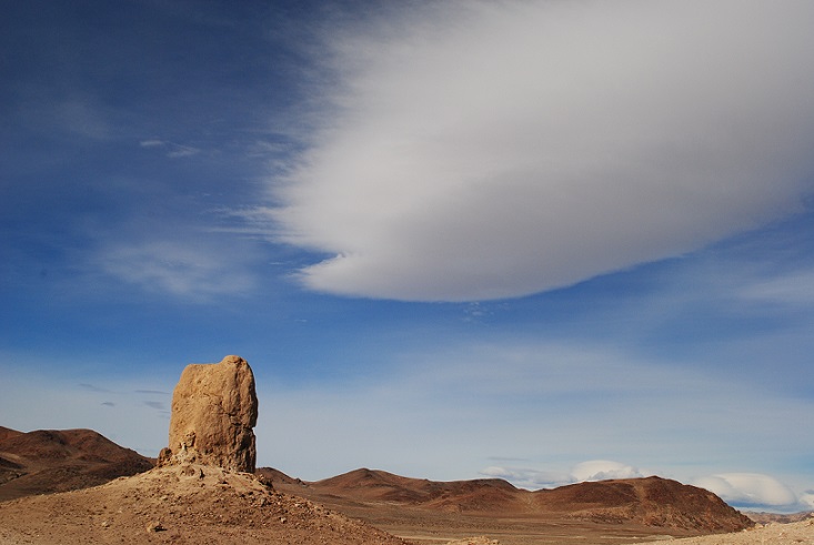
I lingered there, reading and then taking some photos of the landscape and trains resting on the tracks. There were some cool cloud formations that also caught my eye.
Lenticular
Spaceships landing?
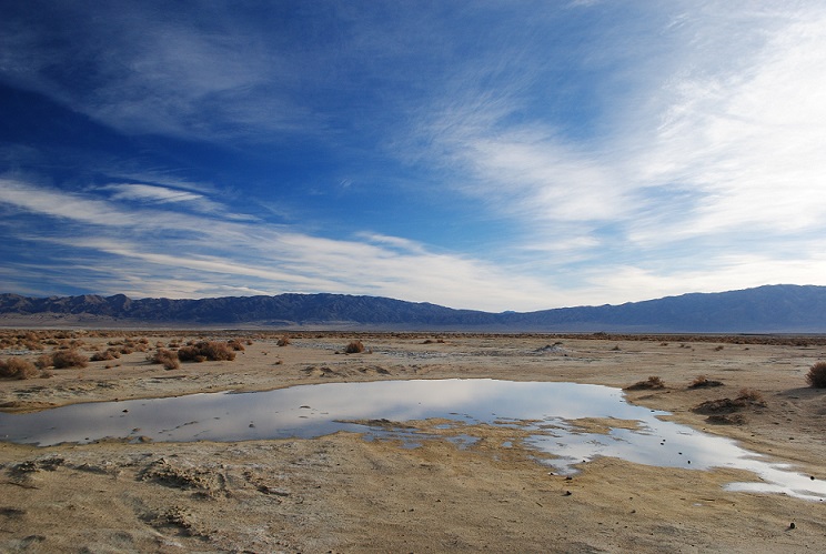
Rain pond
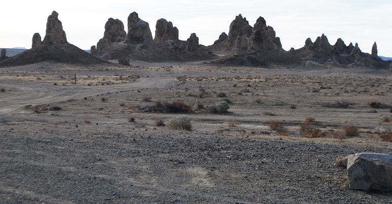
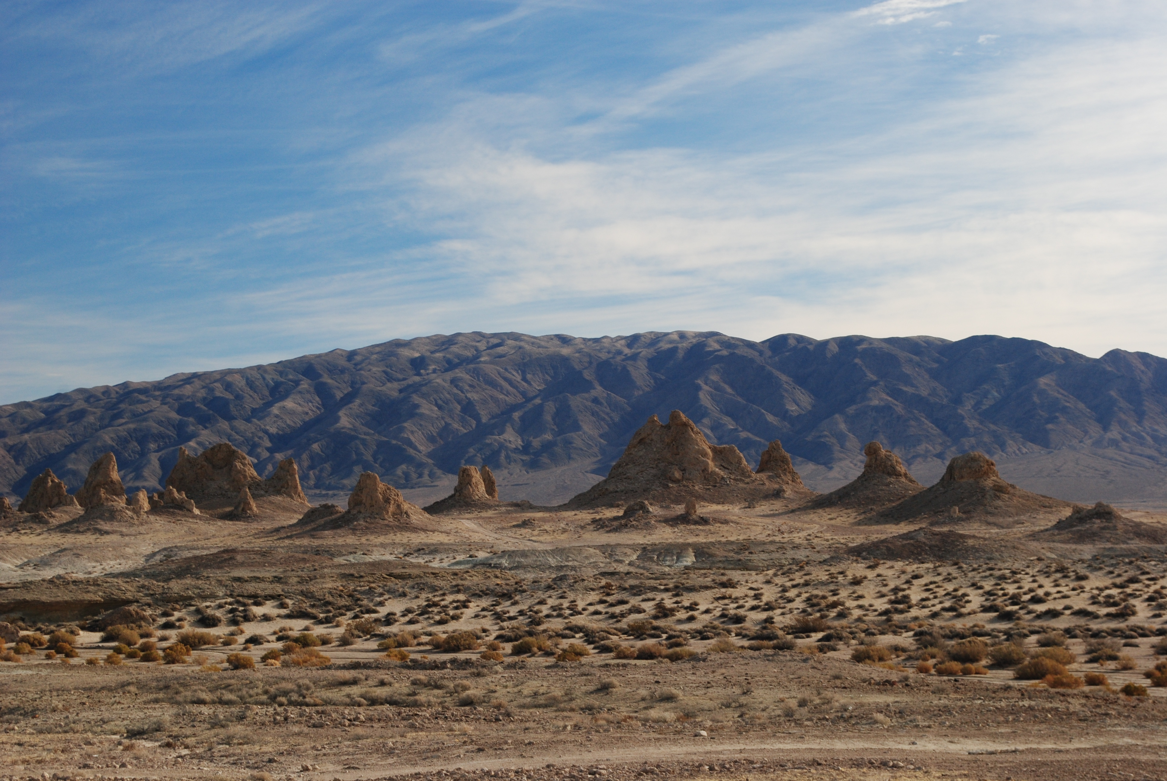
The five-mile dirt road to the landmark had received recent rains, so it wasn’t as sandy as I remembered. When I arrived at the plateau that overlooks the monument, I realized the drive down the hill to the Pinnacles didn’t look so bad, and saw other vehicles, including a huge RV, down below. How the heck did that RV make it down the steep drive, I wondered. You have to realize that the Pinnacles lie in a basin. To really experience them, you need to get down there. The drive down the gravelly slope was so easy, I felt silly.
And then, I had my real surprise! Trona Pinnacles is expansive! You can’t even see all of it from the plateau. Narrow dirt paths snake around more than 500 formations. I had no idea how much I missed on my previous visit.
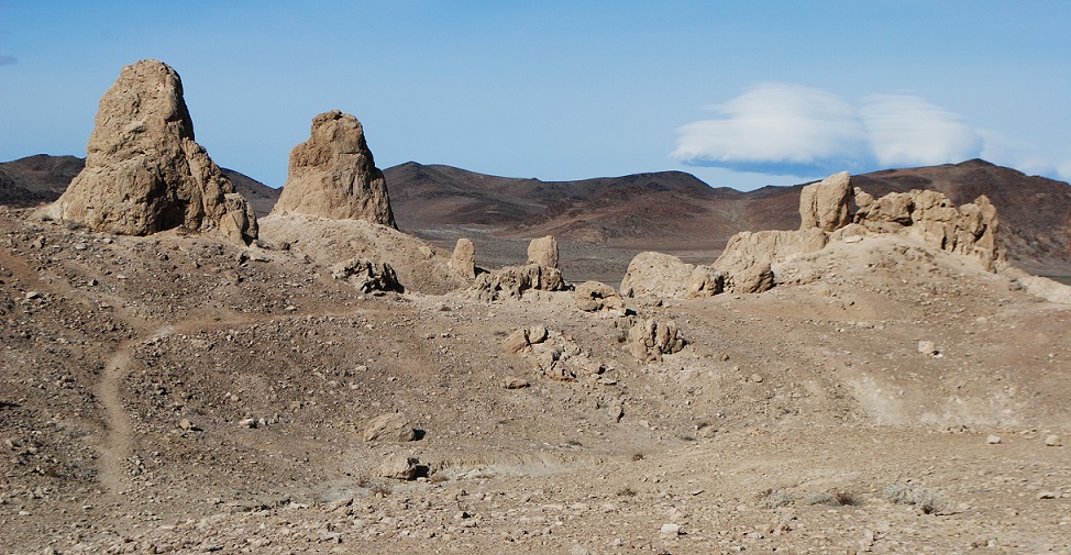
Towers and Dumpy Cones
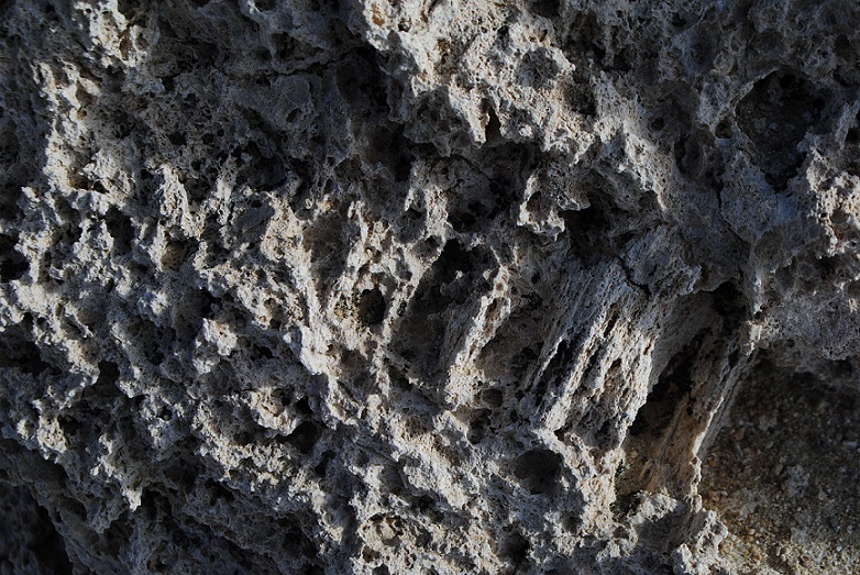
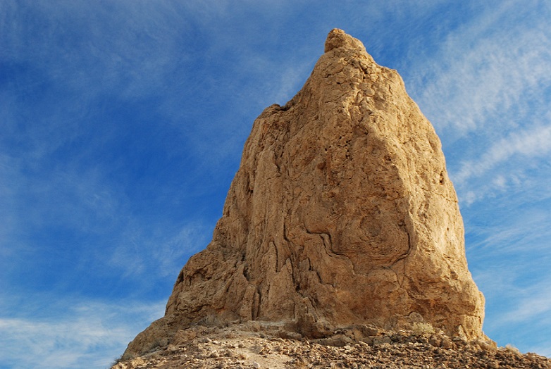
Like their cousins at Mono Lake, the pinnacles are tufa formations, which are primarily calcium carbonate.
Close up of tufa
At Trona, they’re distinguished by age, elevation and shape. The northern, middle and southern groups were formed by different ice ages.
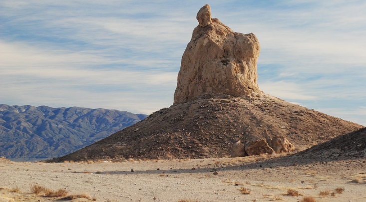
The shapes range from towers and tombstones, to ridges and cones. Towers are the tallest, rising 30-40 feet, while tombstones are “stubby and squat,” rising 20-30 feet.
Ridges are “massive, toothy runs” that can be seen in the northern and middle groups.
Finally, cones are the smallest, reaching only about 10 feet high, and they are “dumpy and mounded.”
On my visit, I concentrated on the tallest and most interesting formations, which turned out to be among the northern and middle groups.
The sun was out; there were some spectacular clouds to add depth to the scenes. The only problem was the WIND. This was my fourth trip to Death Valley and never before had I experienced such winds. I was not going to abandon my photography plans, so I soldiered on.
Each time I got out of the car, I had to fight hurricane-like gusts. I was afraid the wind would snap off the car door! I had to use all my strength to close the door. It goes without saying that any hiking was out of the question.
During my visit, I saw only a couple other cars, and I suspect it’s not heavily visited.
A Wealth of Minerals
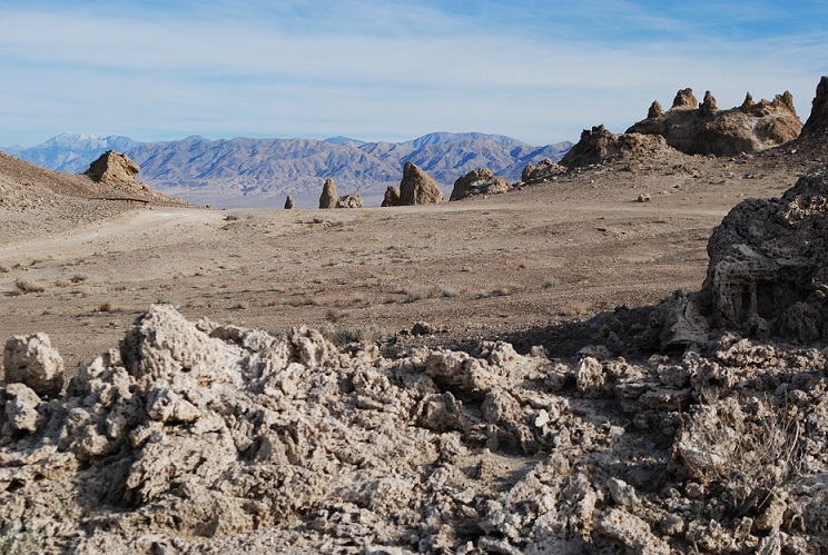
You can spend as much time as you like at Trona Pinnacles. It’s fairly easy to access, unfenced and free of fees.
Don’t expect much from the town of Trona, beyond a convenience store and gas, if you need it. With a population of about 1,900, it’s a sad little “blink and you miss it” hamlet that is centered on the mining activity in dry Lake Searles. The name of the town comes from the abundant mineral trona, one of many extracted by Searles Valley Minerals. Lake Searles once held water, eons ago, but as it slowly evaporated, the water left behind many minerals. In the 1800s, the dry lake became the scene of many mining operations. First, there was borax, famously being carted out by 20-mule teams. Later there was an Epsom salt operation, and now, a multitude of minerals is produced, including salt, borax, boric acid, and halite.
The natural landmark lies in Searles Valley, just south of Panamint Valley, and isn’t far from Naval Air Warfare Center China Lake. It’s also within the California Desert National Conservation Area.
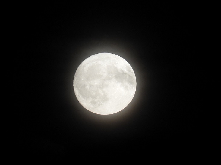
The October full moon is known as the Harvest Moon, but my Witch’s Datebook says it’s the Blood Moon. I wonder where that name came from.
Usually, the September full moon is called the Harvest Moon. But this year it’s in October, due to the closeness to the equinox. Every few years, the autumn equinox falls closer to the tenth month than the ninth.
The October full moon has also been called the Dying Moon and Hunter’s Moon, for the time of year for hunting and preserving meats for winter. Perhaps the name Blood Moon arises from hunting and slaughtering.
Under the bright light of the Harvest Moon, farmers can harvest such crops as corn, pumpkins, squash, wild rice and beans. Scientists explain that most months, the moon rises about an hour later each night.
But the Harvest Moon seems to rise at almost the same time for several nights around the full moon.
Harvest your crops, or just harvest that extra long moonlight to enjoy!
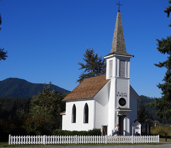
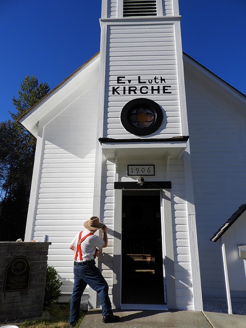
Otherwise known as Elbe Evangelische Lutherische Kirche, the Little White Church sits next to the railroad tracks in the village of Elbe, Washington.
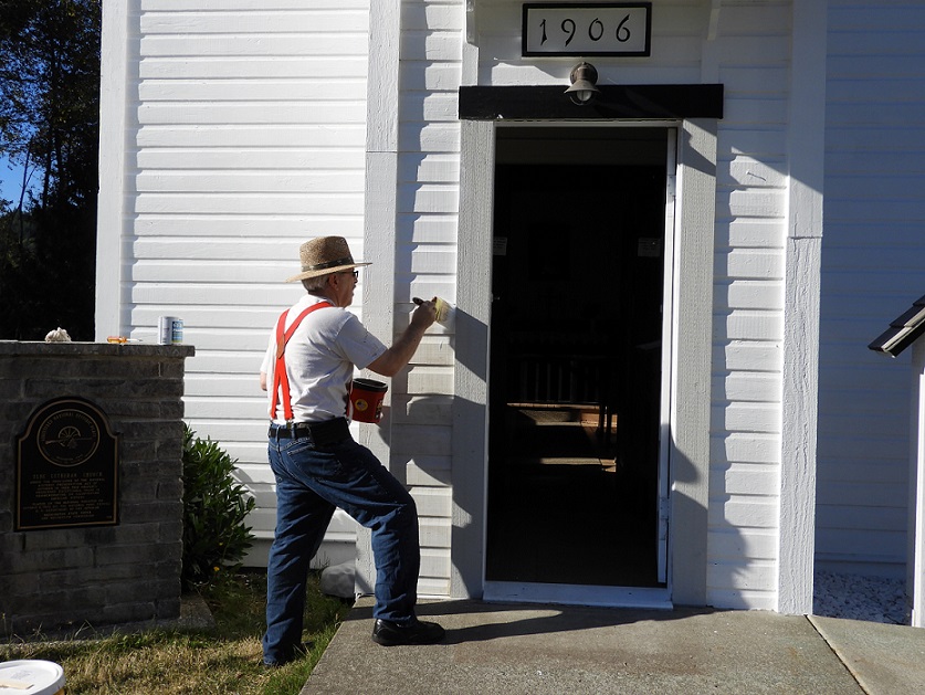
I had passed the kirche before. A couple weeks ago I decided to stop and photograph the bright white building in the morning light. But it wasn’t open then. This time, I vowed to stop if I saw that the church door was open. I approached Elbe and looked over to see that the church door was indeed open. I quickly pulled over and parked.
And, as luck would have it, a gentleman in red suspenders was doing some painting around the doorway. A real Norman Rockwell scene.
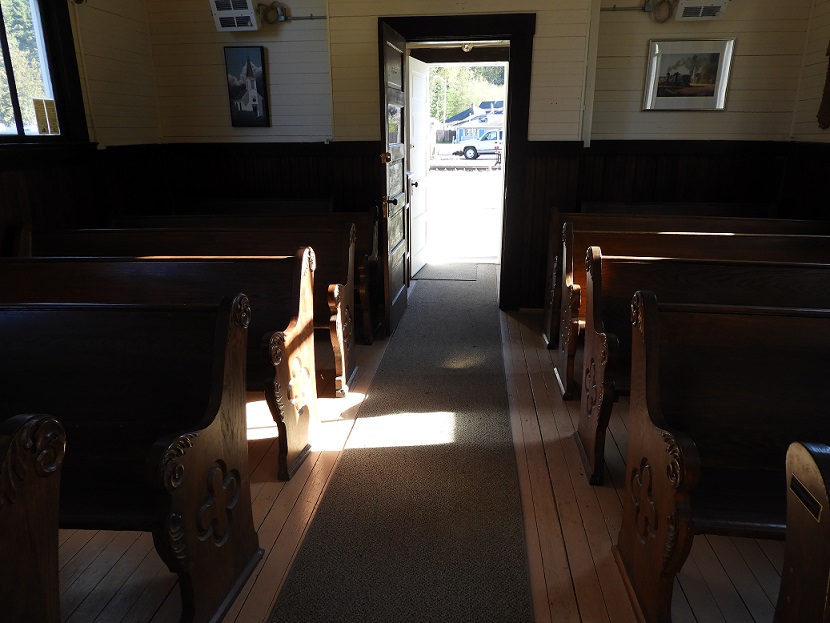
I stepped inside the wee church. Built in 1906, it’s a National Historic Place and one of the smallest churches in the country.
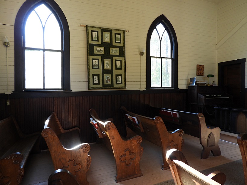
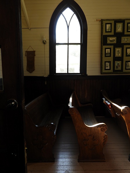
Its lovely wood pews can hold 46 people, though there is no organized congregation and no full-time pastor.
It’s a modest interior. No stained glass windows. The organ is the original Farrand-Votey, built in Detroit.
Services are held once a month, from March through November, and the church overseen by a nonprofit with a board of directors from area Lutheran churches.
The folks who originally settled in the area were immigrants from the Elbe River area near Hamburg, Germany. Locals built the church, which stands 46 feet high at the steeple. The bell is from a locomotive.
As I was ending my visit, I noticed a narrow rope hanging from the ceiling near the door, and a small handwritten note nearby that read “Ring the bell.”
What?? I can ring the bell?! I can ring a church bell! That would be something. So I asked the painter, just to make sure, and he encouraged me to do so. I gave a gentle pull and the bell gave a modest clang. That made my day.
The rope
It can make yours too. If you are driving to Mount Rainier National Park, toward the Nisqually entrance, you’ll go right through Elbe.