Fort Casey: One Foot in the Past, One Foot in the Present

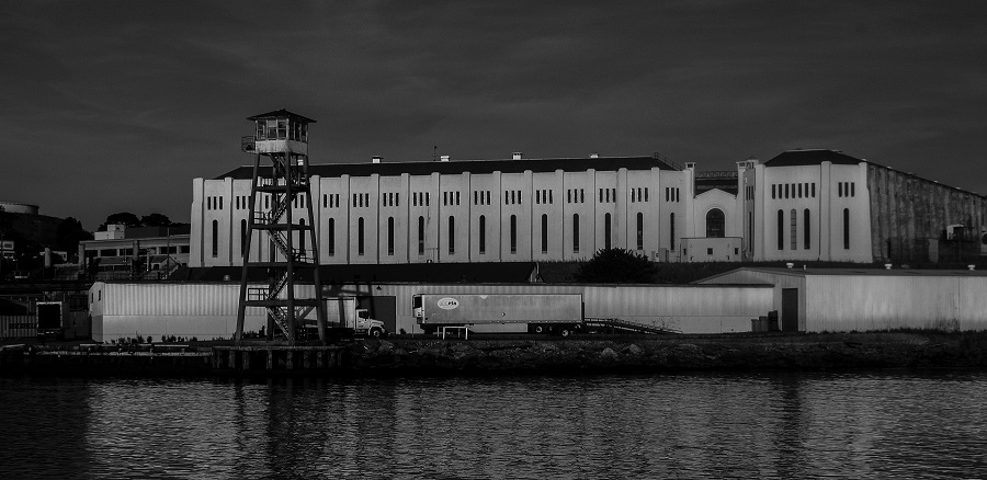
More than 100 years ago, the U.S. government build military strongholds along many coastal areas. In Washington State, Fort Casey is a formidable example of the nation’s determination not only to defend itself, but also the use of the latest technological advances in military power.

Fort Casey was part of a trio of such forts around Puget Sound, including Fort Worden in Port Townsend and Fort Flagler on Marrowstone Island. The Harbor Defenses of Puget Sound, as these forts were known, were created because Admiralty Inlet was considered vital to the defense of Puget Sound. And Puget Sound was important to defend because of its access to Puget Sound Naval Station in Bremerton, and also to the ports in Seattle, Tacoma and Olympia.

The ghost fort and adjacent Admiralty Head Lighthouse stand today as a state park on Whidbey Island, and also a historic district in Ebey’s Landing National Historical Reserve.

Fort Casey was operational from 1899 until 1945. It was built for defense, but spent the greater part of its life as a training facility.

What remains are the fortified structures – batteries or emplacements – with their associated functional rooms and towers. There were 10 batteries, each named for an Army officer.

I was curious about who the honorees were, so here they are.

Battery Schenck: Named for Lt. Col. Alexander D. Schenck, U.S. Artillery Corps, who died in 1905.

Battery Seymour: Named for Major Truman Seymour, 5th U.S. Artillery, who gave distinguished service in the Mexican War and Civil War, and died in 1891 in Italy.

Battery Worth: Named for BG William S. Worth, who served with distinction in the Civil War and Spanish-American War, and died in 1904.

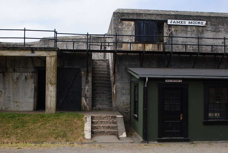
Battery Moore: Named for MG James Moore, Continental Army, who served with distinction in the Revolutionary War, and died in 1777.

Battery Parker: Named for Bvt. 1st Lt. Thomas D. Parker, 2nd Lt., 2nd U.S. Infantry, who was killed during the Civil War in Gaines Mill, Virginia, in 1862.

Battery Kingsbury: Named for Col. Henry W. Kingsbury, 11th Connecticut Volunteers, 1st Lt., 5th U.S. Artillery, who died during the Civil War at Antietam in 1862.

Battery Valleau: Named for 1st Lt. John Valleau, 13th U.S. Infantry, who was killed in Queenstown Heights, Upper Canada, during the War of 1812.

Battery Turman: Named for 2nd Lt. Reuben S. Turman, 6th U.S. Infantry, who died in 1898 at the Battle of Santiago during the Spanish-American War.

Battery Trevor: Named for 1st Lt. John Trevor, 5th U.S. Cavalry, who died in 1864 at the Third Battle of Winchester, Virginia, during the Civil War.

Battery Van Horne: Named for Capt. Isaac Van Horne Jr., 19th U.S. Infantry, who was killed in 1814 at Fort Mackinac, Michigan, during the War of 1812.

Personalized Experience

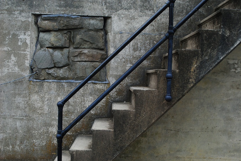
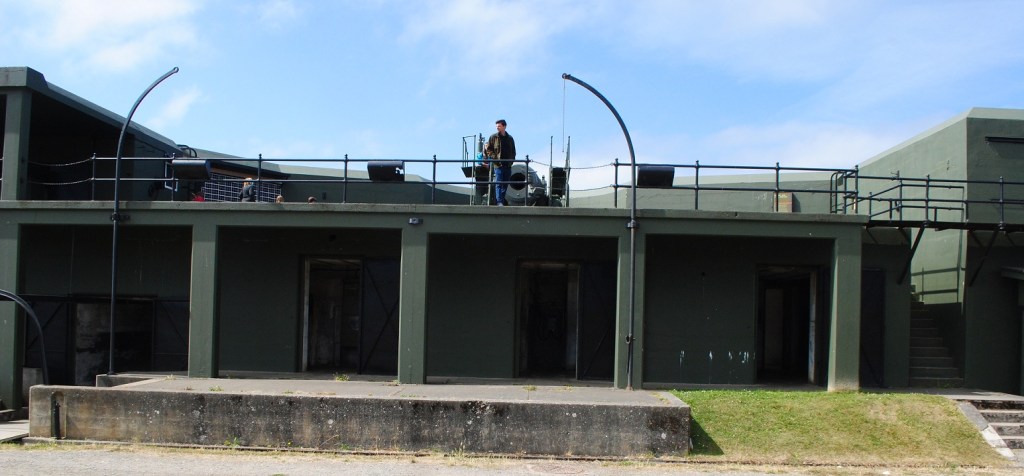
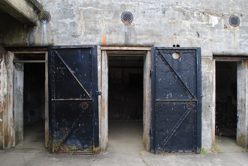
Visiting Fort Casey today, you are free to wander the grounds and emplacements, and the eerie dark empty rooms that once bustled with purpose.

The mazes of rooms are like catacombs and you never know what you might encounter exploring them.

Luckily, I did not find any creepy spiders, monsters or ghosts. I ventured only as far as the light would stretch.

I had wondered whether some were living quarters, but all the rooms were for supplies and operating other equipment within the battery.

Interpretive signs help you understand how the various small rooms were used in each battery.

Living quarters were located away from the emplacements.

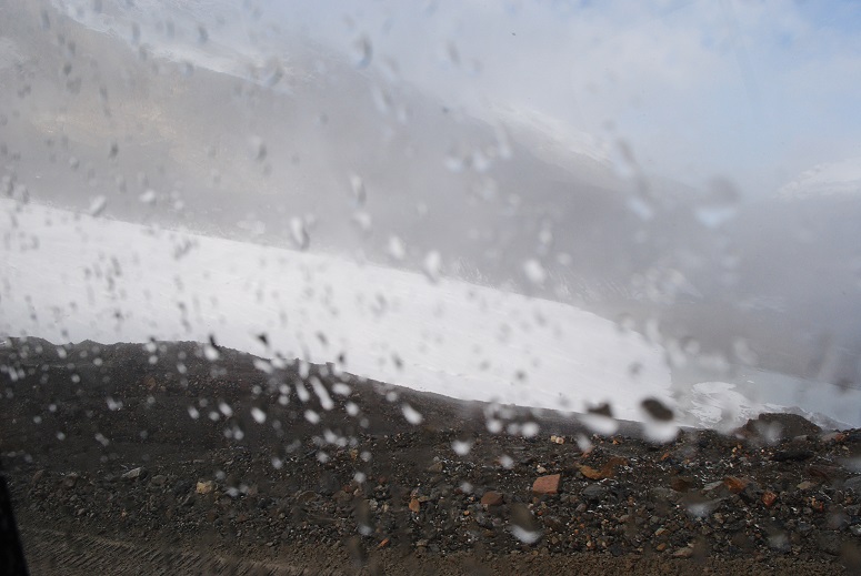
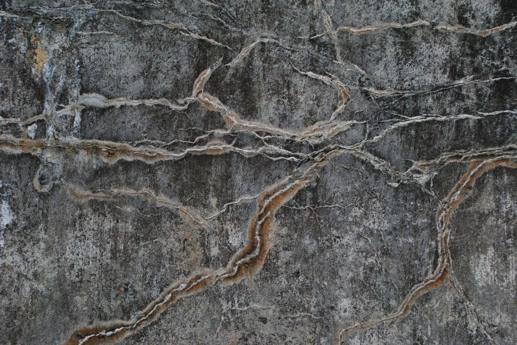
Me being me, I am certain that my experience at Fort Casey was quite different from anyone else’s. From the first battery that I explored, my eyes were instantly drawn to the artistic patterns of minerals leaching out of the concrete walls – efflorescence.

Other folks no doubt just passed by this vacant scene. But I found a treasure trove, and spent a lot of time photographing my finds.

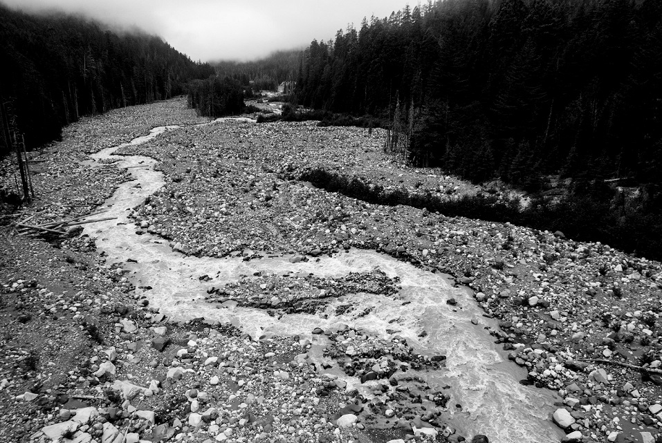
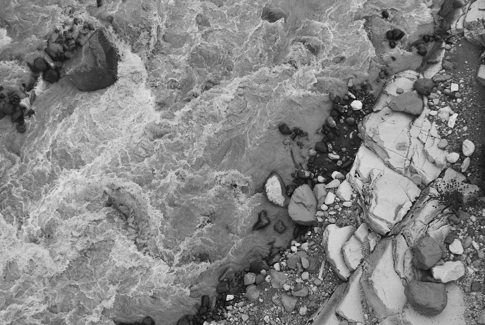
Exterior walls brought to mind landscapes, with mountains and rivers undulating across them, while interiors presented galleries of waterfall-like patterns.

At the same time families were moving through and children were delighting in screaming in the tunnels, I was focused on the art of the concrete, shapes, and light and shadows.

As I moved through the batteries, I also tried to imagine the manpower involved in operating and maintaining the fort. This was not today’s Army! The crowning glory in the fort’s heyday was without doubt its two 10-inch “disappearing” guns.

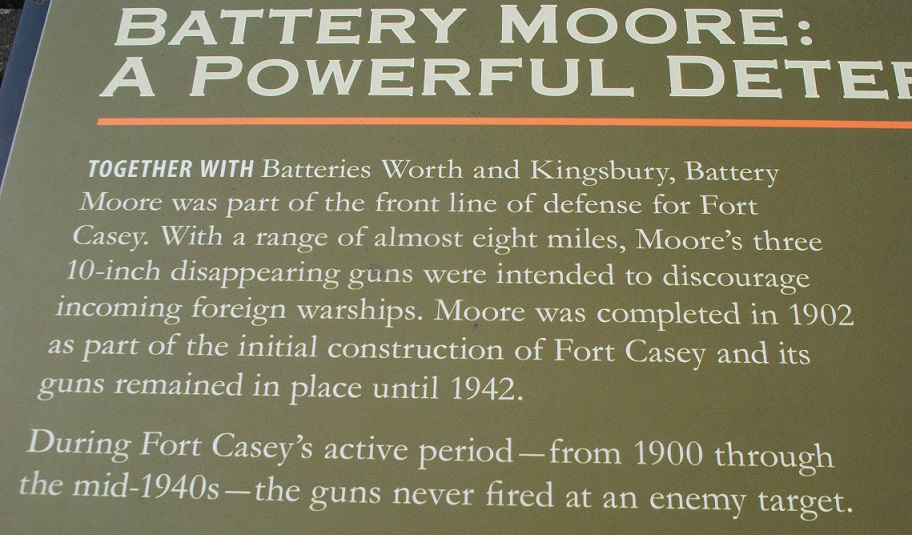
These large cannon-like guns were state of the art in the early 1900s. They could be raised and lowered as necessary, ensuring that they would not be detected when lowered below the battery walls. Note: The two 10-inch “disappearing” guns seen in Trevor and Worth batteries are not the original ones, but similar versions brought back from Fort Wint in the Philippines, where they had been used in defense of Subic Bay.

It’s dizzying to imagine how it would have been under a real attack, with “all hands on deck” at all the batteries. Hundreds of soldiers hurrying, shouting, hauling ammunition, loading the guns, noise and smoke.

The First War

As impressive as these Puget Sound forts were when they were built, technology soon advanced and warships and airplanes made the big guns obsolete. During World War I, Fort Casey was a training facility, readying soldiers for battle in Europe.

When the war ended, the fort was kept under “caretaker” status, and the artillery was removed.

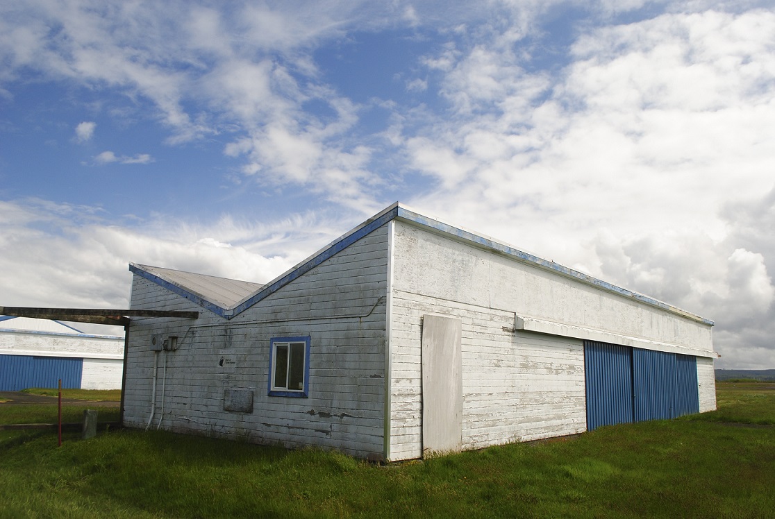
The facility was still used for training for the National Guard and Army Reserve officers. There were officers quarters, enlisted barracks, an administration building, hospital, gym, fire house, commissary, exchange, bakery, and stables.

The Next War

But, as things go, a couple decades later, Fort Casey was called up for service again. As the U.S. was entering World War II, the Army reactivated the fort as an induction center and troop training facility. The old emplacements were outfitted with new anti-aircraft guns.

After this war ended, the fort was vacated and fell into disrepair. The old iron doors looked Medieval to me. The whole place could serve as a great movie set.

Finally, in 1953, it was officially deactivated. Two years later, the state of Washington acquired the property for a state park, and Pacific University acquired the administrative buildings and housing to create Camp Casey Conference Center, which you can see today.

Admiralty Head Light

Just up hill from Fort Casey stands Admiralty Lighthouse. It wasn’t always where it is now. A navigational light at this location predates Fort Casey, but when the fort was on the drawing board, planners realized the light would was going to be in the way, so it was relocated. However, the original structure no longer exists.

The lighthouse you see today was finished in 1903, with an Italianate Revival design. But in time, as happened to Fort Casey years later, the usefulness of Admiralty Head Light was less than desired. In 1922, the lighthouse was deactivated, in favor of the navigational effectiveness lighthouses at Point Wilson and Marrowstone Point. 

Admiralty Light stands 30 feet high. The building was constructed with thick walls to withstand concussions from the fort’s guns and earthquakes. Its fourth order Fresnel lens was removed in 1927 and installed at the New Dungeness Lighthouse.

An Unforgettable Australian Adventure

EPSON scanner image

We’ve all seen the horrendous news coming out of Australia about their dreadful wildfires. My thoughts went back to the month I spent in Australia in the early 1980s. For two weeks I volunteered on an Earthwatch expedition in South Australia, helping collect data for a group of American graduate students from Cornell who were studying the native flora and fauna. My team members were wonderful, diverse American women who shared an interest in wildlife and travel. One of my teammates was Sy Montgomery, who since has become an acclaimed nature writer of numerous books. At the time, we were both journalists and nature geeks, and we haven’t changed much since then. Our team was camped at Brookfield Conservation Park, which is affiliated with Chicago’s Brookfield Zoo. Our leader, Dr. Pamela Parker was a conservation biologist with the zoo then, but has been assistant director there for some time and is still very active in Australian wildlife research.

For two weeks after that I toured South Australia, New South Wales and Northern Territory. It was an incredible experience and one that will always be a fond memory.

I wrote this piece for Earthwatch’s magazine back then, but they did not use it.

So it seems timely to post this now.

Original Earthwatch project description

Note from Cornell University, which was running the project, updating us Earthwatch volunteers about drought impacts

*Photos included here are from scans of my color slides and B&W negatives.


We slice through the darkness with powerful spotlights. My beam illuminates something in the distance – the yellow glint of eyes. Instantly, I sweep back to the spot. We fix our binoculars on the eyes and discover they belong to a kangaroo. Panning the beam slightly, I see there are two kangaroos, frozen briefly in the light. We spend a minute just watching the creatures grazing and moving awkwardly about. Then, we slowly drive on, searching for more animals.

Our project, “Drought Refugia,” has brought us to Brookfield Conservation Park in South Australia.

Brookfield Conservation Park

We’ve come here to study the flora and fauna, with an emphasis on the Southern hairy-nosed wombat. The park was set up as a wombat preserve, but it’s also a refuge for kangaroos and other animals. Last year’s drought had a huge impact on the ecosystems here, and plant and animals alike suffered. Spotlighting is kind of a bonus activity for us volunteers. The researchers do it to catch animal behavior that they can’t see during the day.

Tuesday

As our principal investigator, Dr. Pamela Parker, gives us a tour of the park, we pause to watch a small group of gray kangaroos, survivors of the drought.

EPSON scanner image
Pam Parker with a “sleepy lizard”, AKA shingleback lizard or Tiliqua rugosa

We also feast our eyes on some beautiful birds –swift-flying mallee ring-necked parrots, raucous gray and pink galahs, and a tiny, vivid blue Splendid Fairy Wren.

EPSON scanner image
Galah

Further down the park’s dirt track, we get out of the car for a close look at a wombat warren.

Here, we get our first look at results of the drought – remains of a wombat that had starved to death.

EPSON scanner image
Wombat remains

Pam drives on, rattling off names of trees and shrubs we pass on the way – malleeacaciatriodiaspinifex

EPSON scanner image
Spinifex grows in circles

“How do you spell that? How big does it grow? Does it flower? Is it good food for the animals?” Our questions are endless.

Demonstration of how quickly spinifex burns

Some of the research area

img022 - Copy
Kangaroo bones

Thursday

Today, I and another volunteer are inspecting color-coded wombat warrens.

Wombat warren, a series of burrows and tunnels

We stride across the sparsely vegetated, rock-strewn landscape, going from one warren to the next. We look for signs of activity, either by wombats or other animals, like rabbits or foxes.

We search for the most important unmistakable sign of wombats – fresh fecal pellets. Finding fresh pellets is not difficult, but identifying them can be confusing.

Wombat or kangaroo?

Just when you think you’ve got them pegged as wombat, Pam tells you that female grey kangaroo pellets can resemble wombat.

So, one of the things we learn to do is break open the pellets and examine the plant fibers inside. This takes some getting used to, handling fecal pellets, but after a while our curiosity overtakes our reluctance. Wombat fecal pellets contain short, fine fibers, while kangaroo pellets have fibers of varying lengths and textures. Even Pam sometimes has trouble telling the difference, so I don’t expect to become an expert in two weeks. But my partner and I give it our best try.

Another part of our warren study is to record the number of burrows. A warren can contain anywhere from two to more than 25 burrows in its elaborate tunneling system. After our first few inspections, we learn to walk gingerly over the warrens.

Me testing the ground around the warren, so as not to fall through

More than once we’ve felt our footing suddenly give way. In many instances, we come across bones and carcasses where starving wombats finally collapsed. It’s clear that the foxes found plenty to scavenge.

Earthwatch teammates, Sy, left, and Rhoda studying a dead wombat

Saturday

The research atmosphere in the park is very relaxed. I’m a bit surprised at the research staff’s willingness to trust us with pieces of their important projects. They send us out to collect specific data: avian use of water at troughs; wombat activity; fecal pellet transects, and rabbit behavior. We plunge into our work enthusiastically, trying out our new gear – binoculars, compasses and field guides.

We get to choose what we want to do, and the work gives us some private time alone with our thoughts.

EPSON scanner image
In my blind

One of the first things we learn is that “negative data is still data.” So, it’s important for us to note the absence of wildlife during our observations, as well as any activity. We have opportunities to see not only wombats, but red and grey kangaroos, lizards, echidnas, and many species of birds, including emus.

EPSON scanner image
Emu

EPSON scanner image
Getting lunch with the staff

img040 - Copy
Acacias at sunset

EPSON scanner image
The one living wild wombat we saw

EPSON scanner image
Wally, a “pet” wombat we got to meet in Blanchetown

Saturday Night

Tonight I am spotlighting again. We go bundled against the mild winter night, standing in the open back of a four-wheel-drive vehicle, armed with spotlights in search of animals. Each of us is eager to see the wildlife that is so evasive during the day, and a little crisp night air isn’t enough to keep us glued to the campfire or in our tents. On our trip we glimpse a wombat before it disappears down a burrow. Then we spot a fox, hungrily tearing at some food, and later, a tawny frogmouth, a bird of prey.

Monday

What a lucky sight! Two emus have come to drink at the trough I’m watching.

EPSON scanner image

Until now, none of the volunteers had seen any signs on them except for their flat, circular “pies.” I suspect the emus are a male and female, after checking the head coloring in the field guide. As they are drinking, the emus are making low, booming sounds. When they finish drinking, they walk off as quietly as they came.

Thursday

The vegetation research is expanding and we have a chance to record density, growth and variety of species. EPSON scanner image

Only after getting down on my hands and knees do I discover the beauty of the microscopic flowers: candy cane-striped spears the size of toothpicks, and tiny yellow, purple and white flowers.  EPSON scanner image

EPSON scanner image

They all seem so fragile, I’m afraid to step anywhere. Pam says some of the plants take years to regenerate. In times of little or no rainfall, their root systems stay alive, enabling the plants to spring to life at the next rainfall. Pam has been very excited at the return of ephemeral plants and flowers, and her excitement infects us all. EPSON scanner image

More and more, we realize the devastation of the drought.

EPSON scanner image
                                                                          Ever-present thistle

Sunday

Brookfield Conservation Park has been a marvelous learning experience.

We’ve seen and done things no ordinary tourist ever could. The clear skies, sunsets and star-filled nights, the moaning ravens, bounding kangaroos, wombats and the warmth and patience of Dr. Parker, the research staff, and the park ranger are hard to leave behind.

I, for one, vow to return.

* * * * * * * * * * * * * * * * * * * * * * * *

A Walk on a Glacier

DSC_0546
Edith Cavell Glacier

Last fall I visited Jasper National Park in Alberta, Canada. My first time in Alberta. I was excited to see the Canadian Rockies close up. The timing was perfect for glorious fall foliage. The changing elevations and landscape in the park offered a mix of seasons, first fall, then a bit of spring, then a bit of winter, and back to fall. I was well prepared with a range of clothing.

One of the popular excursions in the park is a chance to “walk” on a glacier, the Athabasca Glacier.

DSC_0397
Athabasca Glacier

I knew it was a touristy thing to do, but how many chances do you get to do that? To reach the glacier area, I drove the Icefields Parkway, winding through the Columbia Icefields, to the visitor center. I picked a tour time and bought my ticket. Luckily I had time for a nice warming lunch before heading to the glacier. DSC_0400 - Copy

An outside deck at the visitor center provided an ideal seat facing the mountains and glacier. And, the sun added the perfect touch.

It reminded me of when I visited Switzerland, gazing at the alps on a sunny winter day, from a dry and snowless path. It didn’t seem right.

DSC_0398
A bus heads up to the snow coach

As the time for my bus ride to the foot of the glacier approached, the sky closed in and a sudden snow squall let loose!

DSC_0399

No doubt, this was the coldest, snowiest part of the park. I enjoyed the view going up the slope to where we would transfer to the giant snow coaches.

We climbed aboard. We could see the glacier.

DSC_0407
The glacier, through the snow coach window

The coaches are well-equipped for moving over snow. Moving is a relative term. Crawling is more like it. As one goes up the snow-packed road, one is likely going back down. We pause to let one go by. The stream of tourists proceeds on schedule every day.

DSC_0411 - Copy
View from our snow coach

I had every confidence in our driver to keep us safely on the road. His job seemed a little treacherous, but to him it may have been just another day at work.

When we arrived at the parking area, the snow passed, the sky cleared and the sun came out. There were a couple other coaches and groups of travelers already scattered across the ice. Some were posing, some lying on the ice or otherwise frolicking.

DSC_0412 - Copy


DSC_0442

Though it was sunny, it was quite windy on the glacier. I noted the various state of dress of the visitors.

DSC_0439

Most were well prepared, but some, I thought, had to be beyond freezing. With a cover of snow, the ice still posed dangers. I walked gingerly. We had to stay within the specific area that was deemed safe.

The scene was a mix of international visitors, a good match for the row of flags of all nations that whipped in the gusts.

For a brief time, it was like there were no countries. Just us, the ice and snow, frozen in time. The scene took my mind to Antarctica. I know there are similar flags there too, whipping in similar winds, in a similarly frigid white landscape. DSC_0425

DSC_0431

It was perhaps odd to see such unnatural bright colors in the arctic-like landscape. It brought us back to our individual national identities.  Like the other visitors, I finally found my country’s flag. It didn’t feel like anything special. It was simply a curiosity, a photo opp. After all, it wasn’t the pole. It was Canada.

DSC_0437

DSC_0447

Textures

DSC_0449

DSC_0451

DSC_0415

Having had enough time to take it all in, we boarded our snow coaches for the slow journey back to the bus.

I was glad for the experience. I was glad to have seen, touched and walked on something that is, in fact, going away.

DSC_0452

Sometime after my liftetime it will cease to exist.

Photos Don’t Lie

DSC_0394
Historic comparison of Athabasca Glacier

The Unassuming but Eerie Façade of San Quentin

I got to see it recently while taking a ferry from Marin County to San Francisco. There it was, silently glowing gold in the late afternoon sun, with a guard tower nearby. Just a simple building at the edge of the water. There was no one outside that I could see. I had to imagine those inside.

DSC_0297 - Copy

With only water between us, I almost got a chill seeing San Quentin State Prison in real life. After all, it’s the stuff of 1940s black and white movies, in which gangsters get their due in the end. I immediately had a vision of Humphrey Bogart, dressed in shades of gray, with his classic sneer and heavy five o’clock shadow.

bw1

Among those sent there are all men who have received the death sentence in California. There have been executions in the past, but none have taken place since 2006. In 2019, the governor ordered a moratorium on executions. Almost 700 men remain on “death row.”

The maximum security prison opened in 1852 and is the oldest in California. Pretty tough to escape from there, eh? Some have tried, but no one has ever successfully fled the prison.

bw3

Oddly, the tough prison has served as a setting for numerous films and concerts. Johnny Cash performed for prisoners twice, once with inmate Merle Haggard in the audience. B.B. King and Metallica later performed there.

Bogart was indeed tied to San Quentin: he played an escapee in the 1947 film “Dark Passage.” Several other movies used the facility, including Woody Allen’s “Take the Money and Run.”

The prison has evolved somewhat since it opened. There are now programs to rehabilitate prisoners who are able to be released, and they do have access to exercise, education and entertainment. But for me, San Quentin will always be that cold, concrete place swathed in black and white, where the baddest of the bad simmer inside.

bw2

I’m glad to be on the “outside.”

Tom-A-to, Tom-AH-to

There’s an ad jingle in my memory cells that goes something like this, “Who put eight great tomatoes in that little bitty can? You know who, you know who, who, who.” For some reason, the word Sacramento sticks in my mind along with it.

When I was in the Sacramento, California, area recently, I learned that tomatoes are a huge crop there. A lovely painted vintage-style sign at the tomato processing plant in Woodland verifies that fact.

DSC_0224 (2).JPG

Surrounding Woodland are farm fields as far as the eye can see. No doubt many of those perfectly aligned rows get planted with the red fruits every year.

California grows 95 percent of the more than 12 million tons of tomatoes produced in the U.S. Those fruits come to our tables as fresh tomatoes, canned, paste, sauces, juice and ketchup. The state’s Central Valley is the heart of tomato country. The tomatoes are processed – cooked, crushed, diced, canned, etc., right there in the Central Valley.

The plant I saw in Woodland is among the few processors left in California. DSC_0226 (2).JPG

Statistics I found from 2008 show that there were 225 tomato growers in the Central Valley, farming some 277,000 acres, and working with 16 commercial canneries.

DSC_0239.JPG

But, in case you didn’t know, the tomato is not native to North America. It is said to have originated in South and Central America. It made its way over to Europe in the 1500s. Not surprisingly, Italians were the first to start growing and eating them. Not too long after that, other countries began growing them, but only as items of curiosity. Using them for food had not really caught on yet.

It wasn’t until the 1700s that tomatoes started to be grown in the young United States. Farmer-gardener that he was, Thomas Jefferson naturally took to growing them. But there was still widespread belief that they were poisonous, as members of the nightshade family.

DSCN2098.JPG

Now we know better. Tomatoes, which are mostly water with a little bit of fiber, are  highly nutritious, providing vitamin C, potassium, vitamin K1, lycopene, and beta carotene, among others. And, how about they are just plain delicious! Who doesn’t love a fresh tomato sandwich? Where would pasta be without sauce?

But even as bountiful as the tomato crop appears, and as endless as our appetites are for tomato products, it remains a risky and costly commodity to produce. Tomatoes like sun and heat, but not too much. California is known for a long growing season, but also for a lack of water. Fuel to power mechanical harvesters, fertilizer and water eat into any farmer’s profits. Throw in unpredictable weather.

DSC_0110 (2).JPG

Thankfully, we now have small and organic farms growing heirloom tomatoes in almost any state that we can buy locally and at our farmers’ markets. We don’t have to depend on big footprint, long-distance crops, at least part of the year. I, along with millions of other Americans, plant my own in my frontyard garden every year. DSC_0834.JPG

Each season is an exciting unknown: which varieties will I try? Which ones will taste best? I know that plants sold locally will do fine in my zone. My favorites have been Black Krim and Green Zebras, but I always aim to pick at least one new one to try.

Once thought to be poisonous, tomatoes are beloved and devoured by the tons. The perfect tangy, juicy tomato is the Holy Grail of our summer gardens. Let’s hope that no matter how our climate evolves, we’ll always have tomatoes.

DSC_0324.JPG


Textures and Tones

On a recent day that began very overcast, I visited Mount Rainier National Park. There are several rivers in the park, and the Nisqually is one of them.

river1

Here it is a very narrow, shallow ribbon cutting through a rocky bed. You can see the low clouds over the valley.

river2

These were shot in color, but I have converted them to black & white, to focus on the patterns in the water and colors and patterns in the rocks.

river6

The tone of the water reminds me of chocolate milk.

These views were shot from a bridge over the river.

river4

river5


rocksriver3

The Invisible Wall at Boquillas

I crossed the border to visit Boquillas del Carmen, a tiny rural village next to the Rio Grande in the prinicipality of Ocampo, in the Mexican state of Coahuila. The town was recently featured in a New York Times article in which the reporter visited border towns to portray life on each side. At the time, Boquillas was suffering from the U.S. government shutdown; it’s largely dependent on tourism.

The U.S. makes it simple for its citizens to venture to the other side. I had taken my passport along on my trip to the Big Bend area of Texas, just in case something strange arose, such as a need for prove my citizenship. You never know, right?

A few days before my trip began, the shutdown ended and the passage to Boquillas opened up again. I hadn’t planned on going over, but a few days into my trip I decided I could fit it in, and, why not? I had never been south of the border, and it was a quirky opportunity.

On the day of my crossing, I drove through Big Bend National Park to the little southwestern style Border Crossing Port of Entry building.

I went in and showed my passport to the agent. He looked through my backpack. OK, that’s it. I was approved to go.

“How do I go?” I asked the agent. “Through that door and follow the path to the river,” he pointed. I stared at The Door. The magical door to the other world.

I returned to my car briefly to figure out what to wear and take, and then walked excitedly back to the building. I gave a nod to the agent, ensuring he remembered just seeing and approving me, and opened The Door.

A lovely welcoming sign outside the port of entry building

I found the dirt path and walked the short distance to the river bank. I looked across. There it was: Mexico. The storied rowboat that I had read about awaited me.

The Rio Grande is narrow and shallow here, facilitating friendly relations and easy passage and trade between countries over the past centuries. Even the customs agent had seemed easy going and not too concerned about anything.

The boat trip lasted maybe two minutes. I admired the oarsman’s strength and wondered whether he was the only one who had to make the round trips many times a day, every day of the week.

On the Mexican bank stood many local men, who waited to take visitors by burro, horseback, or pickup truck into town. I opted for a burro, after seeing most tourists on them.

Burros waiting

A couple of firsts: first time in Mexico, first time on a burro (or donkey, as they are interchangeably used).

My guide was selected for me, by a process unknown to me, and he then selected my burro. Daniel was my guide and Machete was my ride.

Preparing Machete

I hoisted myself up to the animal’s back. It was not an easy task.

Daniel

The saddle was hard and the walk into town was sometimes bumpy on the dirt track. If a truck was coming down the road, Daniel would shout “Burro,” and Machete would move over. Again, I wondered how many times in a day or week that Daniel did this. I paid $5 for the boat ride. I paid another $5 for the burro ride. How much did Daniel get to keep? He did not own the burro, so I imagine there is a big cheese somewhere who owns the burros and “employs” the guides.

Me and Machete

When we got within sight of town, it was time for me to dismount, so Daniel could tie up the burro where he could rest, and we could walk up the hill.

Horse and burro resting area


Here come the tourists

I did not ask too many questions of Daniel, but I did learn that he was born there and has lived there all his life. It’s a hard life, I’m sure.


But the village, with a population of about 100, is run entirely on solar energy!

Solar energy panels for the village.

A colorful bar front

Daniel gave me a tour of Boquillas, during which we passed very modest homes, a couple restaurants, a bar, a grocery store, a school, a health clinic, a customs office, and the solar energy facility. I was amazed at that, and happy for the residents. I especially liked the colorful buildings.

Modest homes

Disused buildings

In front of many homes, along the street, there were tables filled with handmade crafts. It seems everyone makes the same items: small beaded, wire-framed figures of ocotillo cactus, roadrunners, spiders, scorpions and such, and embroidered objects and T-shirts.

My little handmade roadrunner and ocotillo, each just a few inches tall.

Many items proclaimed No Wall and No Al Muro. I wanted to get something with that message, for sure.

Dunes

One surprising feature of my tour was a look at some sand dunes. I have seen sand dunes before, so I wasn’t too enthused when Daniel offered to show me theirs. But, when we got to the viewpoint, yowza! It was stunning.

It was lunchtime and I had to choose a spot to try the local cuisine. I settled on one and sat outside with Daniel.

My favorite decor at the Boquillas Restaurant

We both enjoyed “Mexican” Cokes, made with Mexican sugar, the owner proudly pointed out. Another first for me! I offered to buy lunch for Daniel, but he declined. Another American couple sat at a nearby table.

While we waited for our food, we tourists stepped inside the small eatery to check out the crafts for sale. Women were busy in the small open kitchen, making our food. There were T-shirts and religious items, along with table cloths and food items. When I spotted a shirt with a burro, I had to get it. Machete would live on once I returned to Seattle.

It was easy to see how tourism is the life blood of Boquillas. I couldn’t buy something from everyone there, but I could help in my small way. I tried not to seem like the typical American tourist, and I hope I succeeded. I had purchased a couple items from a woman near the other end of town, and then after meeting Daniel’s wife and young son, I bought a couple more from them.

Daniel’s wife, with her handicrafts

Daniel prepares to take me back to the rowboat

Then it was time to head back across the “big” Rio Grande. We collected Machete and I hoisted myself up again. I turned and waved “Adios, Boquillas.” When we got to the river, the boat was waiting, with the other couple already seated.  I dismounted, said goodbye to Machete, thanked Daniel and started to walk toward the boat. Suddenly Daniel said, “My tip?” I was startled. I had not even thought of a tip! I quickly went to my wallet and found a few dollars.

Savoring the last minutes on the Rio Grande

Back on U.S. soil, the couple and I looked at each other and were sad that our little adventure had ended. We chatted about how we wanted to do more traveling.

I kept thinking I should have given Daniel a much bigger tip. He had walked me round trip, in the sun, on the dusty trail, showed me all around the village, sat while I ate, and allowed me to take his picture. Because the residents take only cash, I had spent most of my small bills, so I didn’t have much to give except a large bill. I wondered if the burro owner pays the guides at all.

The experience was definitely worth it and I recommend it to anyone who is going to Big Bend. I’m sure visiting Boquillas for a brief excursion into Mexico is a much more personalized and authentic experience than crossing the border at, say, Juarez or Tijuana. And it reinforced the knowledge that we Americans are so lucky to be able to cross borders freely, to come and go, while others are not so fortunate.

Artistic scorpion “window” at the Port of Entry building

American, British Troops Faced Off, but No One Died

Less than 100 years after Americans won independence from the British, way up in the Pacific Northwest, a little-known squabble took place between the two. In the late 1800s, Americans and British soldiers averted actually firing on each other.

A Bucolic Setting

San Juan Island, sections of which today are part of a National Historical Park, had a pleasant temperate climate, and farming, fishing and timber opportunities that appealed to several nations. In the 1800s, it had been visited but not yet claimed. Eventually, ships from England and the U.S. mainland brought military contingents to occupy the territory. Both staked claims to the island and in 1859 they agreed to jointly occupy the island, separated at the 49th parallel, until the water boundary could be settled.

The Land Divided

English Camp occupied the northwest end, while American Camp occupied the southern tip. Soon, British-owned Hudson’s Bay Company located a large sheep farming operation there. In time, other farm animals and agricultural operations were added. The large Belle Vue Sheep Farm was a strategic move on the part of the British to fully establish their claim to the land.

American Camp laundry house

Underlying tensions persisted between the two. The Americans tried to tax Hudson’s Bay but no taxes were paid. Though both countries had military camps at opposite ends of the island, things remained relatively calm between the two communities. Officers and their families even visited with each other.

Changes in the Wind

Summer 1859, everything changed. An American settler shot and killed a pig belonging to the Hudson’s Bay Company. He claimed that the pig had wandered onto his property and, therefore, he shot the trespasser. Though the pig’s owner, who ran the HBC operation, made little fuss about the incident, things escalated rapidly. The time is known as the Pig War crisis. Tensions continued to simmer, with more and more American settlers coming to the island, many squatting on HBC land.

The British wanted the American settlers removed from the island, but American officials said no way. British warships sailed to the harbor, while troops at both camps multiplied. Both sides stood their ground but no war ensued.

Peaceful Solution

Finally, the disputed water boundary went to arbitration by a third party – Germany. An arbitration panel settled the boundary between Canada and the island, and the San Juan Islands became American possessions. In 1871, the United States and Great Britain signed the Treaty of Washington, and a year later the British left the island.

The Pig War had ended diplomatically and peacefully.

Today, little remains of the two camps but visitors can wander their spectacular landscapes.

American Camp


Where Birds and Planes Fly

Birding at Grays Harbor National Wildlife Refuge in Hoquiam, Washington, I walked from the parking area to the trailhead, past these old structures at the little Bowerman Airport.

The absence of people and planes, and the starkness of the hangars against the surrounding landscape and big sky drew me to photograph them.

The blue and white buildings; the blue and white sky; white building and white flowers.

Last time I was out here, the restaurant was still operating and was bustling with hungry customers. The retro décor and classic diner menu were lots of fun. Back then when my birding group stopped there for lunch I thought, what a strange place for a restaurant. But now I see it was likely a sort of landmark that drew birders, pilots, as well as locals for good food and company. Now, it was closed, enhancing or perhaps causing the atmosphere of abandonment.

Part of the Port of Grays Harbor, this airfield has one runway. The facility has fuel, a pilot’s lounge, rental hangars, and is touted as “jet-capable.”

The hangars have seen better days and I wondered whether there were any planes inside. What could be the purpose of the oddly shaped roofs?

I don’t know how often planes use the airport, but nearby, birds and birders flock to the wetland habitat at the wildlife refuge. Particularly in spring, the salt marsh and mudflats host thousands of migrating shorebirds. Raptors also are drawn to the abundance of prey.

This landscape is a magnet for wings of different sizes and shapes.