
Since I moved to the Pacific Northwest 11 years ago, volcanoes and earthquakes have become part of my consciousness. Not a very loud part, more of vague background noise, but always there nonetheless.

I live two hours from Mount Rainier, and three from Mount St. Helens, but their presence looms as a constant reminder of the earth’s capacity for fiery temper tantrums. We also have major oceanic plates that are subject to slipping, providing constant earthquake potential.
According to scientists, whom you may or may not trust at this point, the earth is made up of plates, which occasionally move around. This causes inconvenient episodes in human life, such as earthquakes and tsunamis. In geology class, I learned about the process of subduction, when one plate rides over and pushes down another. In my region, the Juan de Fuca Plate is subducting under the North American Plate, in the Cascadia subduction zone. Cool! I get to live in a subduction zone.
But, despite all of this, people here go about their lives without much thought to the potential catastrophes ever present, much like the residents of Hawaii, who dare to live on a dry rocky landscape that once flowed unimaginably hot from the center of the earth.
The Hawaiian islands were formed by lava spewing up, building, building, building, until there were blobs of land where there were none before. And the residents there are no different from those of my region. They are aware of the dangers, but decide that they can live with them. Nature’s beauty and all the other reasons we choose to live where we do outweigh the seemingly distant dangers.
In light of the current eruptions of Kilauea, I wanted to revisit my experiences on Hawaii, Maui and at Mount St. Helens.
Kilauea
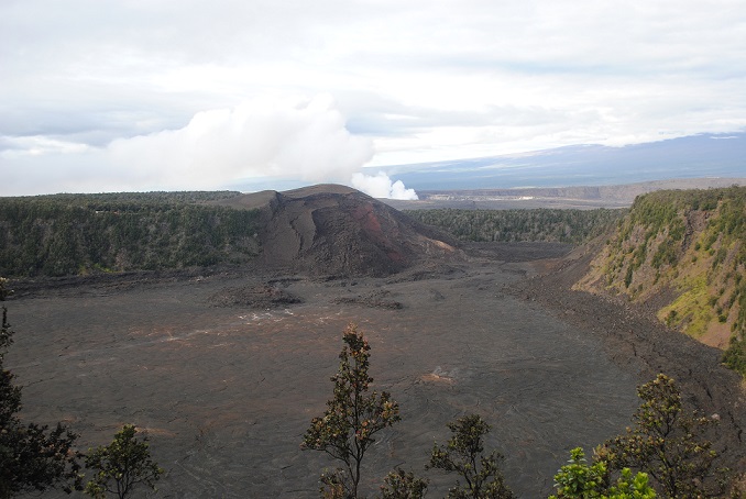
When I visited the Big Island in 2011, half of Volcanoes National Park was closed to visitors because of toxic fumes. Though there were no swaths of red-orange glowing lava flowing at that time, sulfur dioxide is constantly being released from fissures in the earth and can be become concentrated at dangerous levels. I got a mild whiff of it and it’s not pleasant.
Today, it seems that Pele is reasserting her authority. Pele is the revered goddess, the creator of the island. People leave tributes of leaves and flowers to her at the volcano and other places.
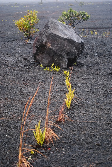
All over half the island, you can see vast fields of blackish boulders and debris from old lava flows. Near the water, the cooled lava shows intriguing swirls and shapes.


Haleakala
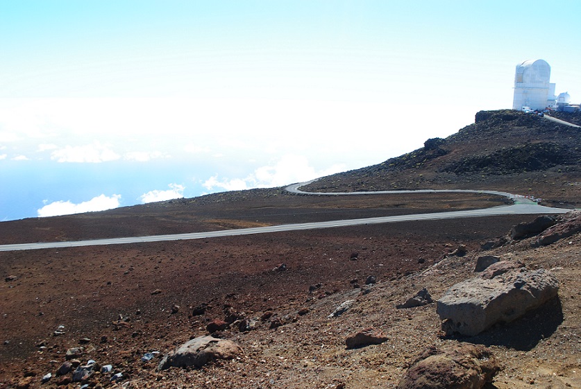
On Maui, the House of the Sun, aka Haleakala, is a major attraction. At 10,000 feet, the volcano dominates the island, providing a cool, arid counter to the warm, moist palm tree-laden lowlands. I visited in February this year.
As you drive into the Upcountry region, you climb slowly and steadily, until you enter a completely different landscape. Vegetation becomes sparse and close to the earth. A rocky crust of lava covers the area. Black boulders and reddish dirt begin to appear. Finally, at the summit, there is a spectrum of red, brown and gray. Known as a shield volcano, Haleakala is thought to have last erupted in the 17th century.
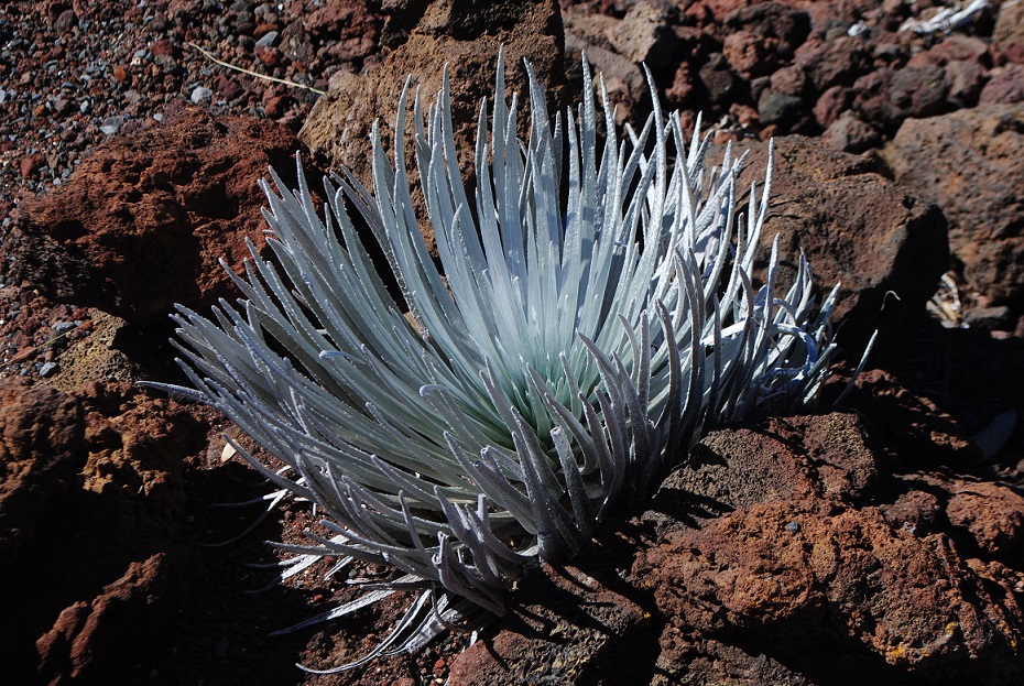
Haleakala is actually a caldera, a large depression left by an erupting volcano. It is a collection of mounds and craters. The unique and beautiful Maui subspecies of silversword grows there, and there is an observatory at the top. All the white stuff in my photos are clouds, not steam.


On Volcanoes, Part 2 continues with Mount St. Helens

Hawaii is the latest in a series of island chains reaching back millions and millions of years.
The chain that is above the water now is like the latest pearl in a string that stretches back to the north-east of Russia near the Baring Straits.
Great writing and photos. I particularly like the dusty reds and browns in the shots inside the caldera.
I heard something about Hawaii, which is that the weak spot in the plates led to an eruption that formed the first set of islands.
Then the plate moved onwards to the south east, cutting off the source that fuelled the formation of the land.
Over time those islands wore away beneath the sea and another island chain spurted out of the weak spot hundreds of miles further along the path.
And now with sonic testing, one can see the remains of the islands – bumps in the sea bed, stretching like a necklace across the Pacific starting from off the coast of Russia and moving south east for thousands of miles over millions of years.
LikeLike
How lovely, David! Well, you have done your research. That’s more than I bothered to do! Very interesting. The earth “begin made.” Can’t beat that.
LikeLike