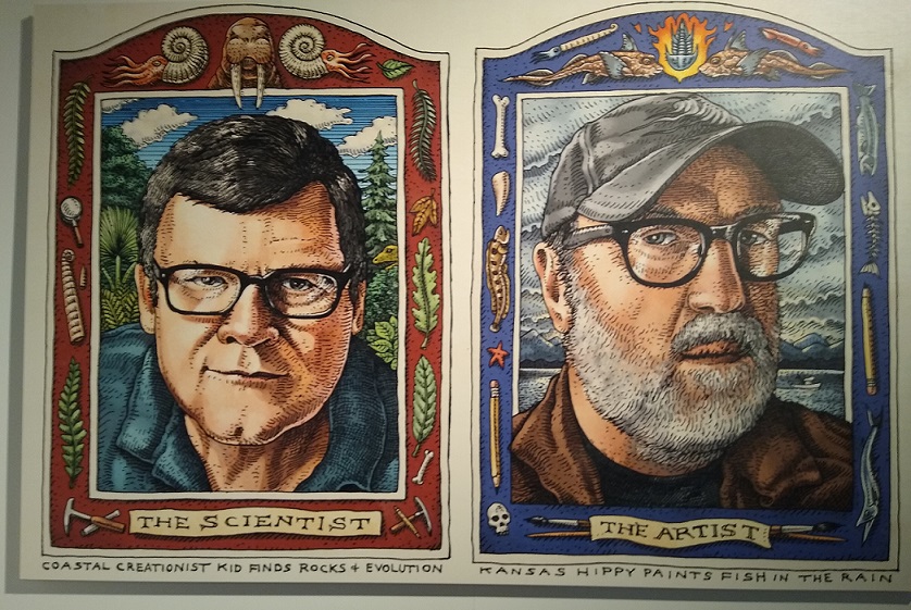
What happens when art and science collide? It’s not always a trainwreck. In some cases it’s more like a delicious union, especially when artist Ray Troll and his buddy paleontologist Kirk Johnson get together. Johnson is the head of the Smithsonian’s National Museum of Natural History, while Troll is a noted artist, fossil fan and conservationist who lives, fishes, and makes art and music in Alaska.
Detail of one of Troll’s illustrations, showing Washington state’s fossil map
I had heard Johnson speak at the University of Washington and seen him on some PBS programs and had become a fan. Last year I became a fan of Troll as well, when I attended a benefit for a conservation organization where he was a speaker. It was then that I first saw his artwork and learned of his enthusiasm for fish, fossils and the earth.
One of the museum’s impressive displays, combining a fossil with its illustration and a projected image
The pair have known each other for more than 20 years, traveling far and wide hunting for fossils. They previously collaborated on a book, Cruisin’ the Fossil Freeway, focusing on the west.
The latest is the sequel, Cruisin’ the Fossil Coastline, chronicling their adventures from coastal California to Alaska in search of mind-blowing fossils.
Gems of artwork and fossils representing their 10-year coastline journey are now on view at the University of Washington’s Burke Museum.
The exhibit of the same name features Troll’s magnificent artwork, Johnson’s expertise and some actual fossils. Troll’s knack for showing creatures both realistically and with a healthy dose of cartoon-like humor is on full view.
The artist and the scientist have come together to create a journey through time that will appeal to all ages.
The Burke recently reopened, with strict protocols. I visited the day after it opened and expected to find a fair number of other visitors as well. What I found was an almost empty museum! I had the exhibit just about to myself and was able to spend all the time I wanted, savoring the artwork, watching videos and ogling fossils.
What I really wanted to do here was share some images from the exhibit and maybe inspire others to check out Troll’s [Trollart.com] and Johnson’s work.
Desmostylians – New to me, these ancient marine mammals are thought to share lineage with horses and rhinos.
This exhibit is on view until May. Troll’s art is enough to lure you in, and the multi-sensory experience will leave you wanting more. The arrangement of paintings, fossils, videos and projections is very impressive. I have to applaud the museum for creating an educational and truly fun experience.
I know I will continue to learn about the captivating creatures I saw. (Here I will put in a plug for Troll’s alt website, Paleonerds.com, which I just visited, and believe you me, it will keep me occupied for millennia of lifetimes.)
The Burke isn’t a large museum, but it’s a treasure, and the research staff does amazing work. Apart from special exhibitions during the year, the Burke is known for its collection of regional Native American items and natural history specimens.
More than 100 years ago, the U.S. government build military strongholds along many coastal areas. In Washington State, Fort Casey is a formidable example of the nation’s determination not only to defend itself, but also the use of the latest technological advances in military power.
Fort Casey was part of a trio of such forts around Puget Sound, including Fort Worden in Port Townsend and Fort Flagler on Marrowstone Island. The Harbor Defenses of Puget Sound, as these forts were known, were created because Admiralty Inlet was considered vital to the defense of Puget Sound. And Puget Sound was important to defend because of its access to Puget Sound Naval Station in Bremerton, and also to the ports in Seattle, Tacoma and Olympia.
The ghost fort and adjacent Admiralty Head Lighthouse stand today as a state park on Whidbey Island, and also a historic district in Ebey’s Landing National Historical Reserve.
Fort Casey was operational from 1899 until 1945. It was built for defense, but spent the greater part of its life as a training facility.
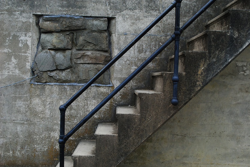
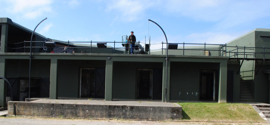
What remains are the fortified structures – batteries or emplacements – with their associated functional rooms and towers. There were 10 batteries, each named for an Army officer.
I was curious about who the honorees were, so here they are.
Battery Schenck: Named for Lt. Col. Alexander D. Schenck, U.S. Artillery Corps, who died in 1905.
Battery Seymour: Named for Major Truman Seymour, 5th U.S. Artillery, who gave distinguished service in the Mexican War and Civil War, and died in 1891 in Italy.
Battery Worth: Named for BG William S. Worth, who served with distinction in the Civil War and Spanish-American War, and died in 1904.
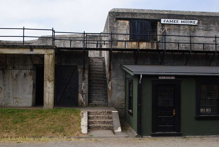
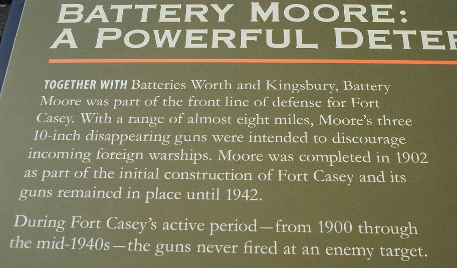
Battery Moore: Named for MG James Moore, Continental Army, who served with distinction in the Revolutionary War, and died in 1777.
Battery Parker: Named for Bvt. 1st Lt. Thomas D. Parker, 2nd Lt., 2nd U.S. Infantry, who was killed during the Civil War in Gaines Mill, Virginia, in 1862.
Battery Kingsbury: Named for Col. Henry W. Kingsbury, 11th Connecticut Volunteers, 1st Lt., 5th U.S. Artillery, who died during the Civil War at Antietam in 1862.
Battery Valleau: Named for 1st Lt. John Valleau, 13th U.S. Infantry, who was killed in Queenstown Heights, Upper Canada, during the War of 1812.
Battery Turman: Named for 2nd Lt. Reuben S. Turman, 6th U.S. Infantry, who died in 1898 at the Battle of Santiago during the Spanish-American War.
Battery Trevor: Named for 1st Lt. John Trevor, 5th U.S. Cavalry, who died in 1864 at the Third Battle of Winchester, Virginia, during the Civil War.
Battery Van Horne: Named for Capt. Isaac Van Horne Jr., 19th U.S. Infantry, who was killed in 1814 at Fort Mackinac, Michigan, during the War of 1812.
Personalized Experience
Visiting Fort Casey today, you are free to wander the grounds and emplacements, and the eerie dark empty rooms that once bustled with purpose.
The mazes of rooms are like catacombs and you never know what you might encounter exploring them.
Luckily, I did not find any creepy spiders, monsters or ghosts. I ventured only as far as the light would stretch.
I had wondered whether some were living quarters, but all the rooms were for supplies and operating other equipment within the battery.
Interpretive signs help you understand how the various small rooms were used in each battery.
Living quarters were located away from the emplacements.
Me being me, I am certain that my experience at Fort Casey was quite different from anyone else’s. From the first battery that I explored, my eyes were instantly drawn to the artistic patterns of minerals leaching out of the concrete walls – efflorescence.
Other folks no doubt just passed by this vacant scene. But I found a treasure trove, and spent a lot of time photographing my finds.
Exterior walls brought to mind landscapes, with mountains and rivers undulating across them, while interiors presented galleries of waterfall-like patterns.
At the same time families were moving through and children were delighting in screaming in the tunnels, I was focused on the art of the concrete, shapes, and light and shadows.
As I moved through the batteries, I also tried to imagine the manpower involved in operating and maintaining the fort. This was not today’s Army! The crowning glory in the fort’s heyday was without doubt its two 10-inch “disappearing” guns.
These large cannon-like guns were state of the art in the early 1900s. They could be raised and lowered as necessary, ensuring that they would not be detected when lowered below the battery walls. Note: The two 10-inch “disappearing” guns seen in Trevor and Worth batteries are not the original ones, but similar versions brought back from Fort Wint in the Philippines, where they had been used in defense of Subic Bay.
It’s dizzying to imagine how it would have been under a real attack, with “all hands on deck” at all the batteries. Hundreds of soldiers hurrying, shouting, hauling ammunition, loading the guns, noise and smoke.
The First War
As impressive as these Puget Sound forts were when they were built, technology soon advanced and warships and airplanes made the big guns obsolete. During World War I, Fort Casey was a training facility, readying soldiers for battle in Europe.
When the war ended, the fort was kept under “caretaker” status, and the artillery was removed.
The facility was still used for training for the National Guard and Army Reserve officers. There were officers quarters, enlisted barracks, an administration building, hospital, gym, fire house, commissary, exchange, bakery, and stables.
The Next War
But, as things go, a couple decades later, Fort Casey was called up for service again. As the U.S. was entering World War II, the Army reactivated the fort as an induction center and troop training facility. The old emplacements were outfitted with new anti-aircraft guns.
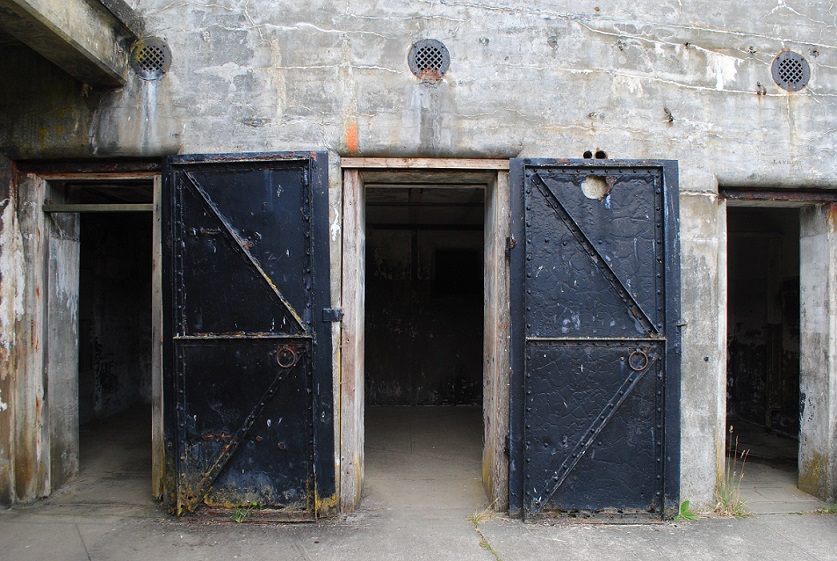
After this war ended, the fort was vacated and fell into disrepair. The old iron doors looked Medieval to me. The whole place could serve as a great movie set.
Finally, in 1953, it was officially deactivated. Two years later, the state of Washington acquired the property for a state park, and Pacific University acquired the administrative buildings and housing to create Camp Casey Conference Center, which you can see today.
Admiralty Head Light
Just up hill from Fort Casey stands Admiralty Lighthouse. It wasn’t always where it is now. A navigational light at this location predates Fort Casey, but when the fort was on the drawing board, planners realized the light would was going to be in the way, so it was relocated. However, the original structure no longer exists.
The lighthouse you see today was finished in 1903, with an Italianate Revival design. But in time, as happened to Fort Casey years later, the usefulness of Admiralty Head Light was less than desired. In 1922, the lighthouse was deactivated, in favor of the navigational effectiveness lighthouses at Point Wilson and Marrowstone Point.
Admiralty Light stands 30 feet high. The building was constructed with thick walls to withstand concussions from the fort’s guns and earthquakes. Its fourth order Fresnel lens was removed in 1927 and installed at the New Dungeness Lighthouse.
No, I haven’t lost my mind. There is a theme here.
I have a fire hydrant in front of my house. Stamped on the top in big letters is “IOWA.” It’s interesting because my mother was from Iowa, Davenport to be precise. She was born and raised in that Mississippi River town. And her father was a fire captain there. Water was, and is, a big presence there.
My hydrant is all about water too. It just got a makeover, painted from dark green to yellow, so it’s easy to spot now. It was manufactured by the Iowa Valve Co., of Oskaloosa, Iowa, which made hydrants from the 1900s through the late 1960s. I think my model is from 1954.
That company was acquired by the Clow Valve Co. in the 1940s, but kept manufacturing under the Iowa Valve name. Today, Clow Valve continues to make hydrants in Iowa, and the design hasn’t changed much from the early models.
We pretty much take fire hydrants for granted. We hardly even notice them, until we are looking for a parking space, right? But we expect that in case of fire, the fire department will come and find the closest hydrant and come to our rescue.
I guess hydrants are sort of like moms. They provide security, comfort and make us feel safe. We expect that from them.
Mom is gone but I have my Iowa fire hydrant. I know she would be tickled about that.
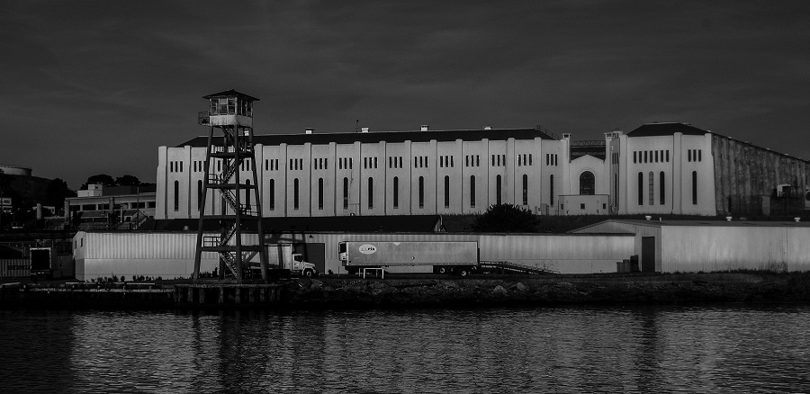
I got to see it recently while taking a ferry from Marin County to San Francisco. There it was, silently glowing gold in the late afternoon sun, with a guard tower nearby. Just a simple building at the edge of the water. There was no one outside that I could see. I had to imagine those inside.
With only water between us, I almost got a chill seeing San Quentin State Prison in real life. After all, it’s the stuff of 1940s black and white movies, in which gangsters get their due in the end. I immediately had a vision of Humphrey Bogart, dressed in shades of gray, with his classic sneer and heavy five o’clock shadow.
Among those sent there are all men who have received the death sentence in California. There have been executions in the past, but none have taken place since 2006. In 2019, the governor ordered a moratorium on executions. Almost 700 men remain on “death row.”
The maximum security prison opened in 1852 and is the oldest in California. Pretty tough to escape from there, eh? Some have tried, but no one has ever successfully fled the prison.
Oddly, the tough prison has served as a setting for numerous films and concerts. Johnny Cash performed for prisoners twice, once with inmate Merle Haggard in the audience. B.B. King and Metallica later performed there.
Bogart was indeed tied to San Quentin: he played an escapee in the 1947 film “Dark Passage.” Several other movies used the facility, including Woody Allen’s “Take the Money and Run.”
The prison has evolved somewhat since it opened. There are now programs to rehabilitate prisoners who are able to be released, and they do have access to exercise, education and entertainment. But for me, San Quentin will always be that cold, concrete place swathed in black and white, where the baddest of the bad simmer inside.
There’s an ad jingle in my memory cells that goes something like this, “Who put eight great tomatoes in that little bitty can? You know who, you know who, who, who.” For some reason, the word Sacramento sticks in my mind along with it.
When I was in the Sacramento, California, area recently, I learned that tomatoes are a huge crop there. A lovely painted vintage-style sign at the tomato processing plant in Woodland verifies that fact.
Surrounding Woodland are farm fields as far as the eye can see. No doubt many of those perfectly aligned rows get planted with the red fruits every year.
California grows 95 percent of the more than 12 million tons of tomatoes produced in the U.S. Those fruits come to our tables as fresh tomatoes, canned, paste, sauces, juice and ketchup. The state’s Central Valley is the heart of tomato country. The tomatoes are processed – cooked, crushed, diced, canned, etc., right there in the Central Valley.
The plant I saw in Woodland is among the few processors left in California.
Statistics I found from 2008 show that there were 225 tomato growers in the Central Valley, farming some 277,000 acres, and working with 16 commercial canneries.
But, in case you didn’t know, the tomato is not native to North America. It is said to have originated in South and Central America. It made its way over to Europe in the 1500s. Not surprisingly, Italians were the first to start growing and eating them. Not too long after that, other countries began growing them, but only as items of curiosity. Using them for food had not really caught on yet.
It wasn’t until the 1700s that tomatoes started to be grown in the young United States. Farmer-gardener that he was, Thomas Jefferson naturally took to growing them. But there was still widespread belief that they were poisonous, as members of the nightshade family.
Now we know better. Tomatoes, which are mostly water with a little bit of fiber, are highly nutritious, providing vitamin C, potassium, vitamin K1, lycopene, and beta carotene, among others. And, how about they are just plain delicious! Who doesn’t love a fresh tomato sandwich? Where would pasta be without sauce?
But even as bountiful as the tomato crop appears, and as endless as our appetites are for tomato products, it remains a risky and costly commodity to produce. Tomatoes like sun and heat, but not too much. California is known for a long growing season, but also for a lack of water. Fuel to power mechanical harvesters, fertilizer and water eat into any farmer’s profits. Throw in unpredictable weather.
Thankfully, we now have small and organic farms growing heirloom tomatoes in almost any state that we can buy locally and at our farmers’ markets. We don’t have to depend on big footprint, long-distance crops, at least part of the year. I, along with millions of other Americans, plant my own in my frontyard garden every year.
Each season is an exciting unknown: which varieties will I try? Which ones will taste best? I know that plants sold locally will do fine in my zone. My favorites have been Black Krim and Green Zebras, but I always aim to pick at least one new one to try.
Once thought to be poisonous, tomatoes are beloved and devoured by the tons. The perfect tangy, juicy tomato is the Holy Grail of our summer gardens. Let’s hope that no matter how our climate evolves, we’ll always have tomatoes.
a bridge composed of several small spans for crossing a valley, dry or wetland, or forming an overpass or flyover. (Wikipedia)
a long elevated roadway usually consisting of a series of short spans supported on arches, piers, or columns. (Merriam-Webster)
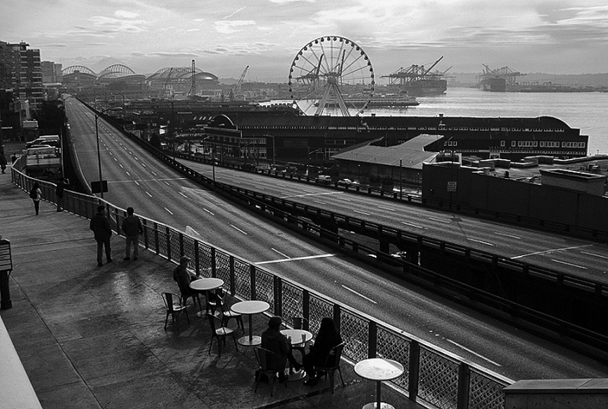
Seattle’s Alaskan Way Viaduct certainly was that. Unlike its more picturesque cousins around the world, this viaduct was not built of stone and did not have attractive arches. It was not a thing of beauty.
The Viaduct along the Great Wheel, with a ferry and West Seattle in the background
It was purely functional. Built of concrete and steel in 1953, it had two levels, one going north, and one going south. It stretched about two miles along the waterfront, affording very pleasant views of Puget Sound and the Olympic Mountains.
The long gray line – the Viaduct bisecting downtown and the waterfront.
That’s the thing that will be most missed by drivers. The views.
Looking north
View at Pike Place Market
The elevated roadway reached the end of its useful life, helped along by the Nisqually earthquake in 2001, which damaged the viaduct. Ever since then, the roadway was closed for a couple days every six months for safety inspections. It was slowly sinking, but every inspection gave the A-OK for it to continue to be used.
However, the debate about how to replace it spanned more than a decade. The final determination was that a tunnel would be built and the viaduct would come down.
After years of drilling the tunnel, the day of reckoning has finally come, a little behind the original schedule. The viaduct has been closed forever, and it’s three weeks till the new tunnel opens.
The paint fairy came once.
What are commuters and drivers to do? Take public transit and have a lot of patience!
Happily, I no longer have to commute. But two days into the new age, I ventured downtown by bus to have a look and take some pictures. What I found was a scene of tranquility. If it could only last.
Less than 100 years after Americans won independence from the British, way up in the Pacific Northwest, a little-known squabble took place between the two. In the late 1800s, Americans and British soldiers averted actually firing on each other.
A Bucolic Setting
San Juan Island, sections of which today are part of a National Historical Park, had a pleasant temperate climate, and farming, fishing and timber opportunities that appealed to several nations. In the 1800s, it had been visited but not yet claimed. Eventually, ships from England and the U.S. mainland brought military contingents to occupy the territory. Both staked claims to the island and in 1859 they agreed to jointly occupy the island, separated at the 49th parallel, until the water boundary could be settled.
The Land Divided
English Camp occupied the northwest end, while American Camp occupied the southern tip. Soon, British-owned Hudson’s Bay Company located a large sheep farming operation there. In time, other farm animals and agricultural operations were added. The large Belle Vue Sheep Farm was a strategic move on the part of the British to fully establish their claim to the land.
American Camp laundry house
Underlying tensions persisted between the two. The Americans tried to tax Hudson’s Bay but no taxes were paid. Though both countries had military camps at opposite ends of the island, things remained relatively calm between the two communities. Officers and their families even visited with each other.
Changes in the Wind
Summer 1859, everything changed. An American settler shot and killed a pig belonging to the Hudson’s Bay Company. He claimed that the pig had wandered onto his property and, therefore, he shot the trespasser. Though the pig’s owner, who ran the HBC operation, made little fuss about the incident, things escalated rapidly. The time is known as the Pig War crisis. Tensions continued to simmer, with more and more American settlers coming to the island, many squatting on HBC land.
The British wanted the American settlers removed from the island, but American officials said no way. British warships sailed to the harbor, while troops at both camps multiplied. Both sides stood their ground but no war ensued.
Peaceful Solution
Finally, the disputed water boundary went to arbitration by a third party – Germany. An arbitration panel settled the boundary between Canada and the island, and the San Juan Islands became American possessions. In 1871, the United States and Great Britain signed the Treaty of Washington, and a year later the British left the island.
The Pig War had ended diplomatically and peacefully.
Today, little remains of the two camps but visitors can wander their spectacular landscapes.
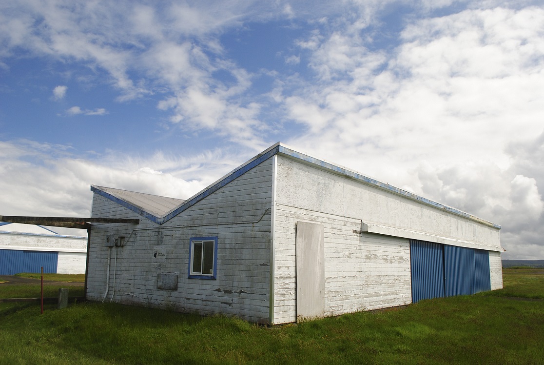
Birding at Grays Harbor National Wildlife Refuge in Hoquiam, Washington, I walked from the parking area to the trailhead, past these old structures at the little Bowerman Airport.
The absence of people and planes, and the starkness of the hangars against the surrounding landscape and big sky drew me to photograph them.
The blue and white buildings; the blue and white sky; white building and white flowers.
Last time I was out here, the restaurant was still operating and was bustling with hungry customers. The retro décor and classic diner menu were lots of fun. Back then when my birding group stopped there for lunch I thought, what a strange place for a restaurant. But now I see it was likely a sort of landmark that drew birders, pilots, as well as locals for good food and company. Now, it was closed, enhancing or perhaps causing the atmosphere of abandonment.
Part of the Port of Grays Harbor, this airfield has one runway. The facility has fuel, a pilot’s lounge, rental hangars, and is touted as “jet-capable.”
The hangars have seen better days and I wondered whether there were any planes inside. What could be the purpose of the oddly shaped roofs?
I don’t know how often planes use the airport, but nearby, birds and birders flock to the wetland habitat at the wildlife refuge. Particularly in spring, the salt marsh and mudflats host thousands of migrating shorebirds. Raptors also are drawn to the abundance of prey.
This landscape is a magnet for wings of different sizes and shapes.
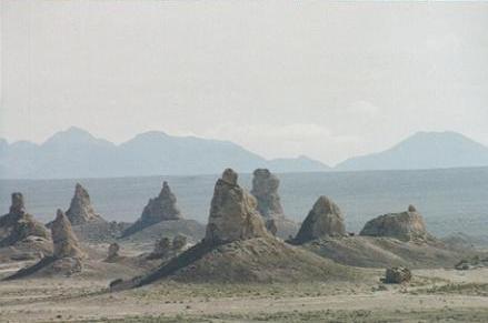
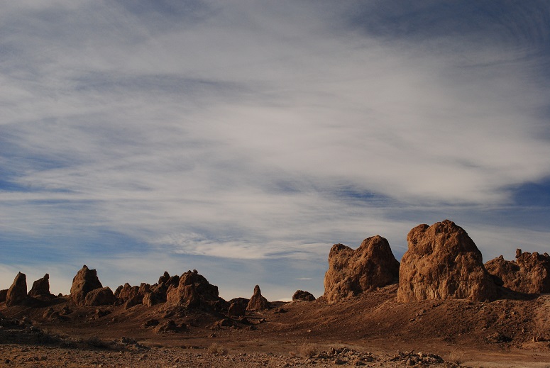
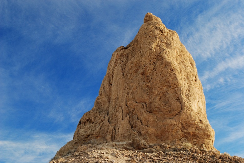
If Trona Pinnacles looks like something out of a sci-fi flick, that’s because it has indeed served as a backdrop for several movies. You might have heard of some of these: Star Wars, Star Trek V, Battlestar Galactica, Planet of the Apes.
First Impressions
I first drove to the Pinnacles in 2005, during a visit to Death Valley National Park. I had set aside part of one day to make the drive to the somewhat remote area managed by the Bureau of Land Management. But it took more than an hour to get there, and I had made arrangements for an afternoon horseback ride at Furnace Creek, back in Death Valley. By the time I got to the Pinnacles, I had about a half hour to spend there if I wanted to make my ride. I peered at the Pinnacles from a plateau that overlooked what I thought was a rather limited formation. There was a steep-looking road down to the Pinnacles, but I “there’s no way I’m driving down there,” I decided. I quickly snapped some photos from the parking area and sped back to Furnace Creek.
First visit
There would be a return trip in my future.
A Closer Look
It wasn’t until January 2017 that I made it back to Trona. I had planned to spend unlimited time there, doing lots of photography and some hiking. I lucked out with a dry day. This time I had rented an SUV, so I had high clearance, though a car could make it.
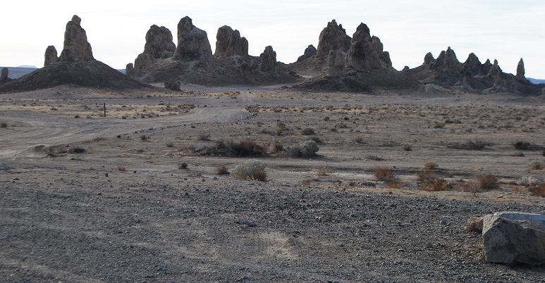
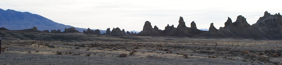
I drove south through Trona, and spotted the Pinnacles, rising like the Emerald City out of the desert. I arrived at the turnoff for the Pinnacles about 10 miles later. At the corner there are some interpretive signs about the human and geological history of the area.
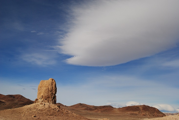
I lingered there, reading and then taking some photos of the landscape and trains resting on the tracks. There were some cool cloud formations that also caught my eye.
Lenticular
Spaceships landing?
Rain pond
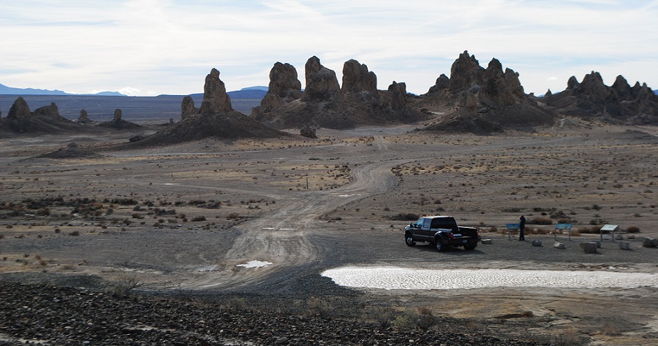
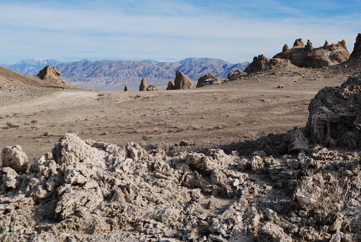
The five-mile dirt road to the landmark had received recent rains, so it wasn’t as sandy as I remembered. When I arrived at the plateau that overlooks the monument, I realized the drive down the hill to the Pinnacles didn’t look so bad, and saw other vehicles, including a huge RV, down below. How the heck did that RV make it down the steep drive, I wondered. You have to realize that the Pinnacles lie in a basin. To really experience them, you need to get down there. The drive down the gravelly slope was so easy, I felt silly.
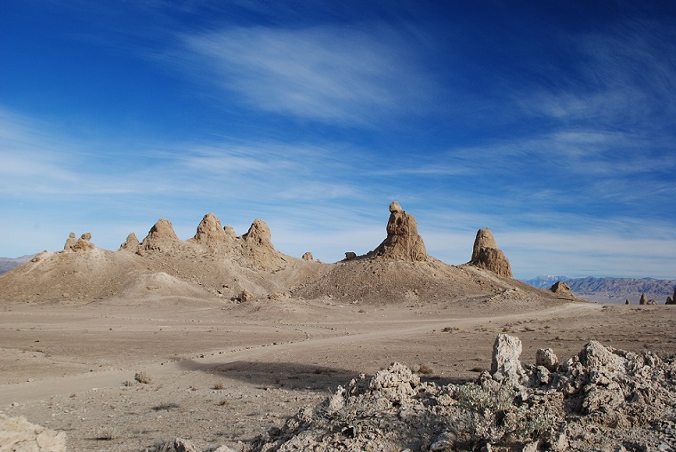
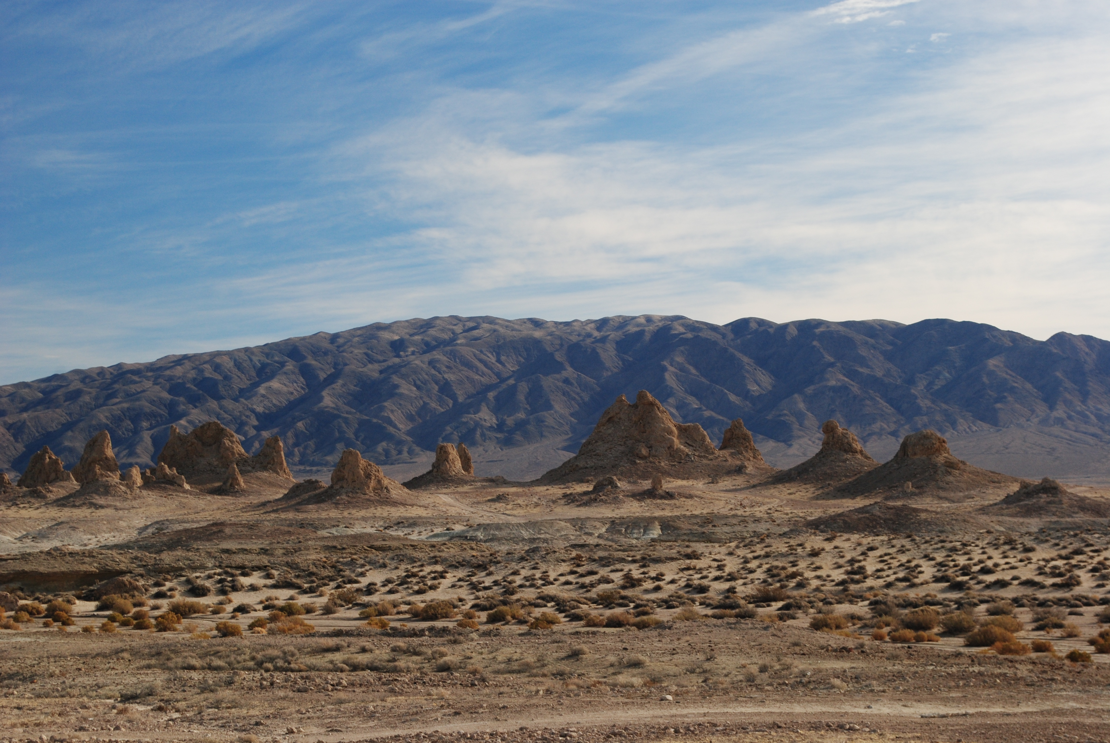
And then, I had my real surprise! Trona Pinnacles is expansive! You can’t even see all of it from the plateau. Narrow dirt paths snake around more than 500 formations. I had no idea how much I missed on my previous visit.
Towers and Dumpy Cones
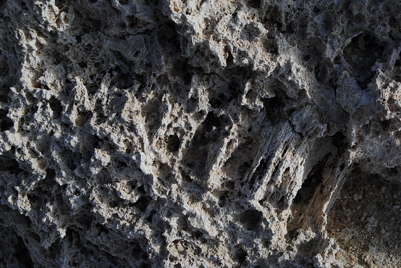
Like their cousins at Mono Lake, the pinnacles are tufa formations, which are primarily calcium carbonate.
Close up of tufa
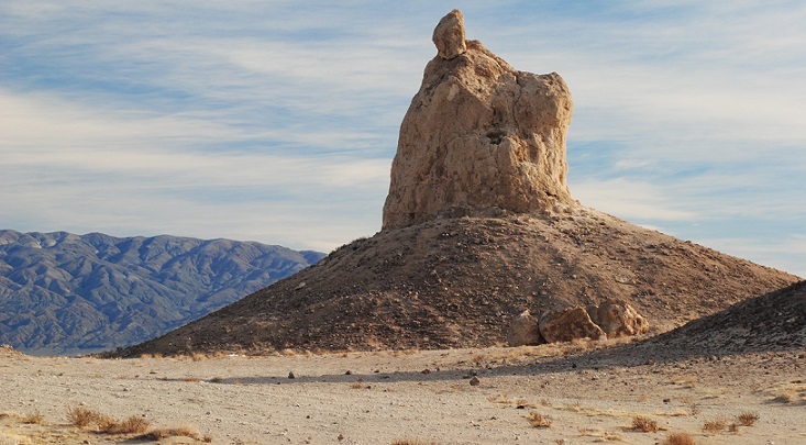
At Trona, they’re distinguished by age, elevation and shape. The northern, middle and southern groups were formed by different ice ages.
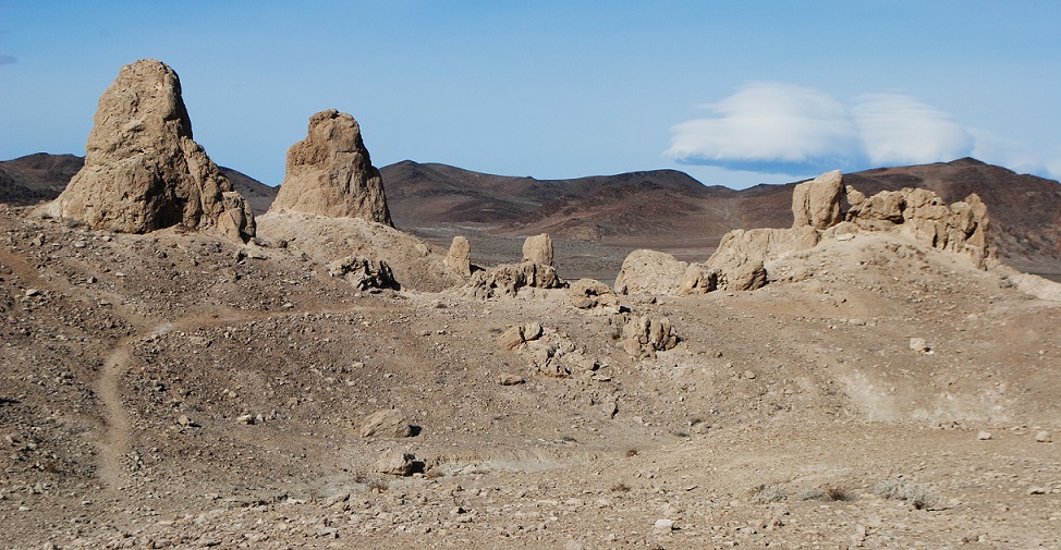
The shapes range from towers and tombstones, to ridges and cones. Towers are the tallest, rising 30-40 feet, while tombstones are “stubby and squat,” rising 20-30 feet.
Ridges are “massive, toothy runs” that can be seen in the northern and middle groups.
Finally, cones are the smallest, reaching only about 10 feet high, and they are “dumpy and mounded.”
On my visit, I concentrated on the tallest and most interesting formations, which turned out to be among the northern and middle groups.
The sun was out; there were some spectacular clouds to add depth to the scenes. The only problem was the WIND. This was my fourth trip to Death Valley and never before had I experienced such winds. I was not going to abandon my photography plans, so I soldiered on.
Each time I got out of the car, I had to fight hurricane-like gusts. I was afraid the wind would snap off the car door! I had to use all my strength to close the door. It goes without saying that any hiking was out of the question.
During my visit, I saw only a couple other cars, and I suspect it’s not heavily visited.
A Wealth of Minerals
You can spend as much time as you like at Trona Pinnacles. It’s fairly easy to access, unfenced and free of fees.
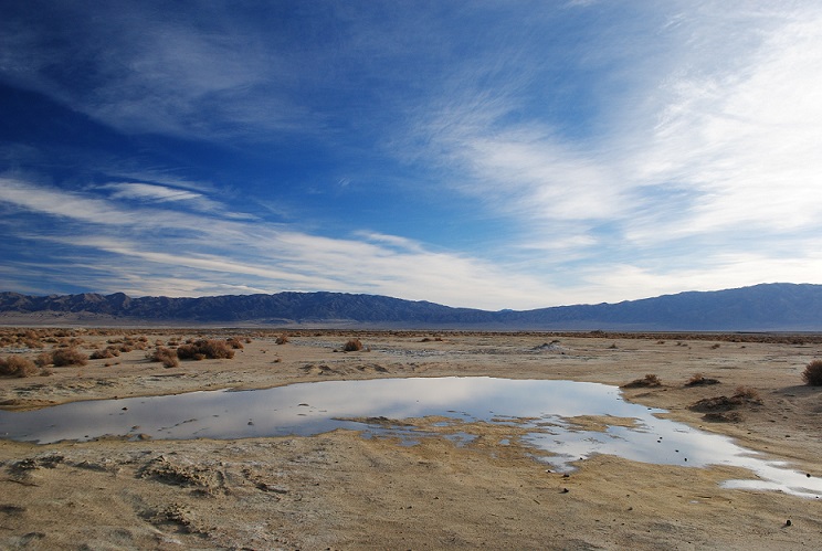
Don’t expect much from the town of Trona, beyond a convenience store and gas, if you need it. With a population of about 1,900, it’s a sad little “blink and you miss it” hamlet that is centered on the mining activity in dry Lake Searles. The name of the town comes from the abundant mineral trona, one of many extracted by Searles Valley Minerals. Lake Searles once held water, eons ago, but as it slowly evaporated, the water left behind many minerals. In the 1800s, the dry lake became the scene of many mining operations. First, there was borax, famously being carted out by 20-mule teams. Later there was an Epsom salt operation, and now, a multitude of minerals is produced, including salt, borax, boric acid, and halite.
The natural landmark lies in Searles Valley, just south of Panamint Valley, and isn’t far from Naval Air Warfare Center China Lake. It’s also within the California Desert National Conservation Area.
When people have birthdays, there’s usually singing. “Happy Birthday to you… happy birthday…“ You get the picture.
But when an inn has a birthday, does anyone sing?
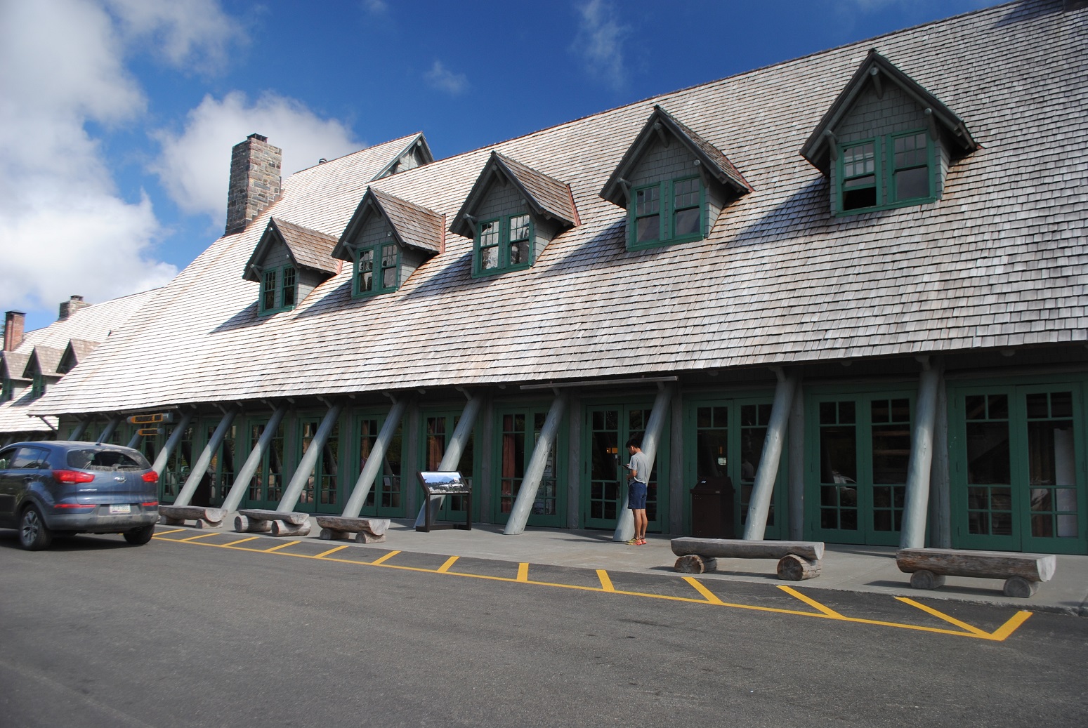
The historic Paradise Inn at Mount Rainier National Park is celebrating its 100th year. Built in 1917, the inn is a classic, rustic, big-timber affair that the national parks are known for.
Back when men were men, and furniture was BIG, this inn set a precedent for other parks. Until then, visitors stayed in Spartan tent camps. The first director of the National Park Service, Steven Mather, wanted the new inn to be a model for other parks. Can you believe it cost only $90,000 to build? Of course, in 1917, that was a lot of moola.
You could say Paradise Inn rose from the very soil around Mount Rainier. Cedar trees damaged in a nearby fire in Silver Forest were salvaged and used in the construction.
The large, heavy tables and chairs in the lobby were made from Silver Forest trees.
Back then, dead trees were not valued and left standing as they are today, largely as wildlife habitat.
If you visit the inn, you can see the original timbers and furnishings.
There is a tall clock that is framed in local wood, along with an upright piano also encased in wood.
With a view of Mount Rainier just steps away, the inn offers 121 simple guest rooms – no telephones, TV, or internet. There are rooms in the main lodge, with shared baths, and rooms with private bath in the Annex, which was added later to accommodate ever-growing crowds of visitors. The structure is getting some renovations and promises to be better than ever.